Showing posts with label Cyberheritage. Show all posts

15 April 2006

Millbay Station

A couple of nighst ago there was a 'ram-raid' on the Plymouth Pavillions in which a large amount of cash was stolen from a cash machine. This in itself has nothing really to do with Transport in Plymouth but the site of the Plymouth Pavillions has an awful lot of interest.
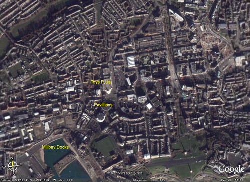
This picture from Google Earth shows the scene as it is now.
(Click on the pictures to get to the Flikr page where you can view them at a larger size for better viewing!)
newmap
The Plymouth Pavillions is at the entrance to Millbay Docks. And this is the key to the site as it was on this very spot that Millbay Station was sat. This was a main line station which was built to the serve the Docks.
Plymouth Data has an excellent history of the Railway Station here.
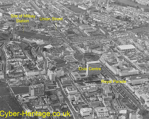
City-centre-path-of-railway

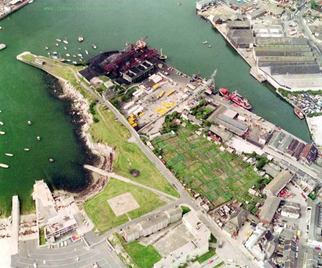
This picture taken from the excellent Cyber Heritage collection was taken in the early 1980's and shows the area before any of the new building work had started. You can clearly see the line of the old railway along the top half of the picture and the large area now occupied by the Pavilions in the top left.
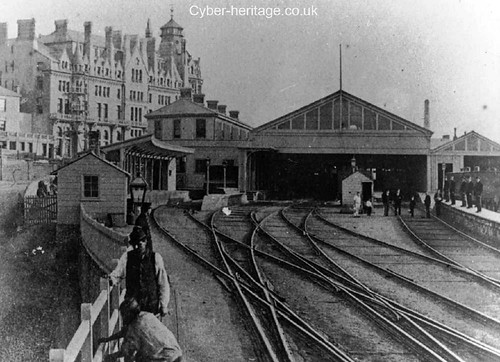
Millbay-Station-Hotel
The picture above also from Cyber Heritage is an old one of the Station itself. The hotel in the background is still there.
I hope to do a bit of exploring around here at some stage to see what if anything is left!

Just one other thing to say for now - the whole future of this site and the Pavillions is uncertain as there are grand plans for this area of Plymouth - and the Pavillions is not included in them, so they may not last that much longer. Although dont get too excited - this is Plymouth after all.

25 March 2006

Teats Hill


Following on from the news that we will soon be seeing Ducks use the slip way at Teats Hill I thought it would be good to have a closer look at the area. The Teats Hill Slipway can be clearly seen in this lovely photo from about 1980 which has come from the excellent CyberHeritage site. (Click on the photos for a bigger view)
If you look at the image below from Google Earth you will see how much the area has changed.
The main change being the new Plymouth Marine Aquarium building which has sprung up. You may also notice the changes behind the aquarium where the dock side has been filled in. The area where the red ship sits above is now dry land and a very nice pub/ restuarant.


There is a whole lot of things I could point out in this area where there is so much history - and indeed Transport History I could fill pages and pages. One day I will have more information on a proper Plymothian Transit web site which will link the now with the then.


didbygraham

31 January 2006

Gunnislake Branch Line Threat?


The picture above shows the point where the Tamar Valley branch Line passes under the main line as it crosses the River Tamar on the magnificent Royal Albert Bridge. This line is one of the most beautiful branch lines in the country and very popular. It was saved from the Beeching Axe in the 1960s because Gunnislake in particular is not well served by good roads so it was deemed necessary to keep the train service.

Some of the history of this line as part of the Callington Branch can be foun on the Train web site, which is well worth a visit to explore more of the hsitory of rail services in this area.

Well today this is Plymouth reports that:

Rural train services in the area could be scrapped by the Government, it has been revealed. In a statement in Parliament, the Department for Transport has revealed that dozens of branch lines and secondary routes could shut.The proposed moves were found within an 83-page document issued alongside a statement by Transport Secretary Alistair Darling. They would be the biggest overhaul of the network since the Beeching report in the 1960s, which led to the closure of 4,000 miles of railway and nearly half the nation's stations.Loss-making services would be transferred onto buses, as a means of reducing the £6bn-a-year subsidy, the document states.Mr Darling's statement, along with the 83-page consultation paper, entitled: 'Consultation on the Implementation of the Railways Act 2005,was designed to set the scene for future rail cuts.


This seems to be preparing the way to cut even more rural rail services just like the Tamar Valley Line. For a government that pretends to be in favour of public transport this is a great way of showing their true colours. I am sure that this story will grow and a lot more will come out in the days ahead. I will certainly be having a good read of this document myself.

In the meantime a photo from Cyberheritage of happier days at Calstock.


For pictures of modern day Calstock Station and others on the branch then visit this page.
didbygraham

12 January 2006

Shakey Bridge


Today was my last day at the Goschen Centre (Yes - I passed my First Aid course and am now a registered first aider!) so I managed to get a few photos of "Shakey Bridge" as its always been known locally although it seems to be called Weston Mill Viaduct officially. Well, you can just see the bridge in the background anyway. The train crossing the bridge is '150247' whatever that is!
I am standing on the road bridge that can be seen on my recent post about Keyham Station which is just behind me, on the other side of this bridge. More info on Keyham Station can be found here.
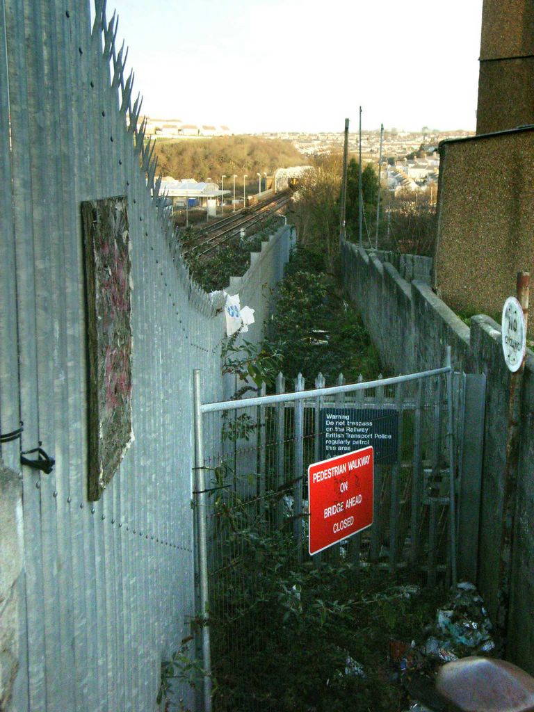
One of the most useful features of this bridge for years was the footpath that ran alongside it as it provided a short cut across the creek and saved a good 40 minute walk along the main road. It was probably this well known path that led to the bridge being known as Shakey Bridge as we always used to enjoy it when a train crossed the bridge at speed as it always shook the bridge and was great fun when I was a child. This path has since been closed - and by the look of it this was some time ago and there are no plans to re-open it. I guess this is down to Health & Safety issues.

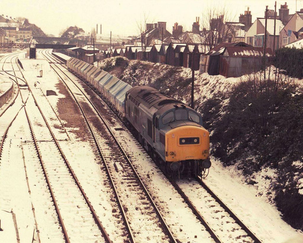
Finally another treat from Cyberheritage - from 1986 this time with this shot in the snow. In this shot you can see the branch into HMS Drake and the Naval Dockyard which is just to the right of the train.


didbygraham

09 January 2006

Keyham Station


Today was my first day of the four day course at the Goschen Centre in Keyham so I was able to grab a few photos on my way to work of Keyham Station. Sadly I didn't have time to get down into the station proper and take more photos, and it was too dark to take many after the course had finished at tea time.

Here was are looking back into the Station from the bridge on the Plymouth bound track. wae are looking down the line towards Cornwall. Just past the road bridge you can see top left, is the rail track 'branch' into HMS Drake. More photos from this area soon I hope.


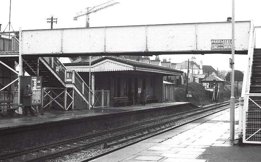
Compare the shot above with this old shot (from the excellent Cyberheritage site). This is actually looking in the same direction but taken from the main centre platform. Although this was never a major station you can see what building there were have been replaced by single bus shelters! Also you may notice the signal box is another missing feature of today's photo.


Our final photo from Cyberheritage was taken in 1981 and was some time after the old photo above. This one is looking back the opposite direction, taken from the road bridge seen in the distance in both photos. You can see the signal box has already disappeared. Otherwise not much has changed between the two old photos. You can also see the road bridge which was my vantage point this morning.

Other News:
The latest on the London Tridents noted in Plymouth mentioned yesterday is that they will not be staying in Plymouth and will be here for the Park & Ride until new buses arrive later in the year. It looks like they will stay in London red livery for the duration of their visit. From what people say they do not sound like pleasant buses at all!

didbygraham

04 December 2005

Park & Ride


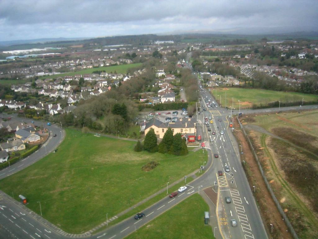
Recently came across this wonderful aerial view of The George junction from August 2004 on the excellent Cyberheritage web site. This area is now almost unrecognisable. The large new Park & Ride site is in the top right hand side of this photo.
didbygraham

23 April 2005

Gdynia Way


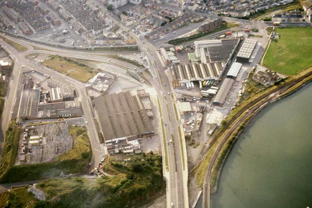
This picture shows Laira Bus Depot circa 1980. Just behind the bus depot there is a road which runs across the picture from top right to top left. This is Gdynia Way. It is now part of the main route into Plymouth and forms a bypass of the old Embankment Road route into the City.
It runs along an old railway track which was originally part of the Plymouth and Dartmoor Railway and was linked to the Tramway which has been featured already in this blog.
The area in this picture has changed a lot since this picture was taken. The bus depot has now gone and is left as a large wasteland - a new retail park is planned. The bottom left there is now a new road running into Cattedown and a new footpath follows the path of the railway track which runs along the river bottom right. The large warehouse buildings opposite the bus depot have been replaced by typical bland retail units.
The reason I was thinking of this area today is because Gdynia Way was partially closed for road works so that all traffic was diverted up through the old Embankment Road route. This had two lanes of traffic being merged into one lane and then being squeezed through the traffic lights which have always been set to give priority to the traffic coming up through Laira Bridge. A bus ride into the City Centre which normally takes 30 minutes took nearly two hours! Dont know who was responsible for the roadworks or the traffic management - but they should be sacked!
This photo is not one of mine but comes from Stephen Johnsons site where many other fascinating aerial photos from this period can be viewed - its well worth alook!


didbygraham