 Marsh Mills Foot bridge Marsh Mills Foot bridge | ||
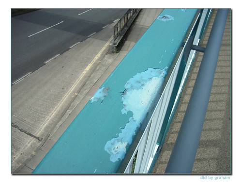
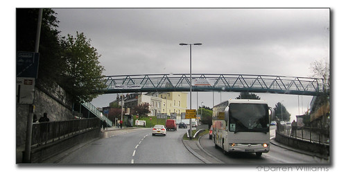
A couple of years ago I had a sister blog site on Plymothian Bridges. It was a bit too optimistic to attempt a blog on such a specialist subject so it soon disappeared but I do still take photos of Plymouth bridges, and now I can start again in earnest. My first for 2010 is the wonderful pedestrian bridge that links Sainsbury's with the housing on the other side at Marsh Mills. Somehow the fact that it is so dirty just adds to its appeal for me. I spend quite a lot of time on the bridge as its a useful spot for taking photographs of traffic coming into the City. The photo below being just one of a set of photos taken at the same time.  I was trying to do something different this time to show off the lines and the curves of the bridge so I have upped the contrast quite a bit to make the most of the harsh light. Its not quite 'art' but I like it! The full set can be found here on my Flickr account. | ||
Further ReadingOmnibuses - Alfreds Bazaar Highton-Ridley - Inquisitive Sheep TGP: Preserved Coaches
|

Showing posts with label Plymothian Bridges. Show all posts
Showing posts with label Plymothian Bridges. Show all posts
13 February 2010
Plymothian Bridges: Marsh Mills


22 October 2008
Bridge over the Plym
©IMHILL (Flickr Blog this)
Came across this fantastic HDR photo of the little bridge over the Plym on Flickr. I think it really captures the scene brilliantly and had to be shared here. Click here for more of his Plymouth photos. Superb!
ps. There may well be interruptions to normal service here over the next week or so as I have finally ordered the new PC which should arrive on Sunday. I will then have a lot of work trying to get the new PC set up and working out what files to copy across from the old one!
07 October 2008
Plymothian Bridges: Coombe Viaduct
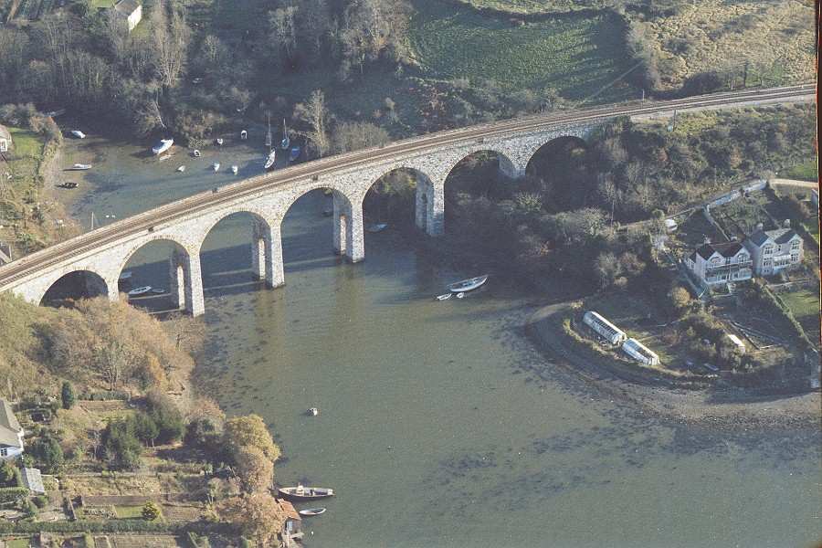
This is actually the second viaduct over this creek carrying the Cornwall Railway line out from Saltash (left) and on into Cornwall. It was opened 19th October 1894.
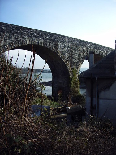
A stunning photo of the viaduct:
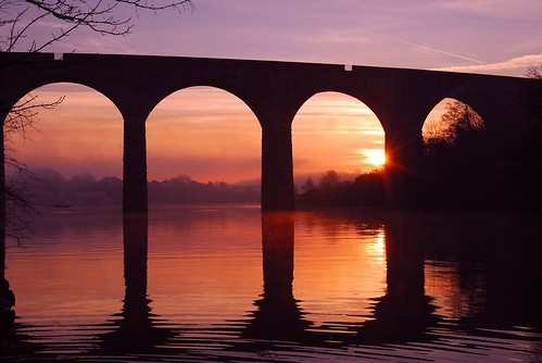
©AndyWelshman (Flickr Blog this). See his other Saltash bridges photos HERE They really are brilliant.
From the Cyberheritage collection we get this great aerial view from the very early 1980's
19 September 2008
Plymothian Bridges 044: Longbridge Road
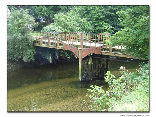
If you stand on the road bridge next to Plymouth Road McDonalds you get this view of the delightful little bridge just up the River Plym.
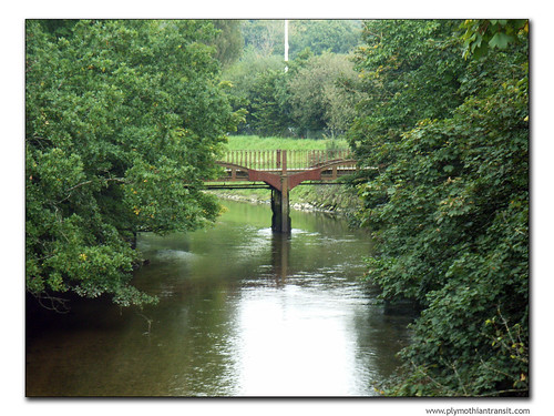
From the other side you get a closer look at the simple metal construction which looks very industrial in this quite serene location.
To get a clue as to what this bridge was for you need to look on the path leading up the the bridge next to the white cottage on the other side of the river:
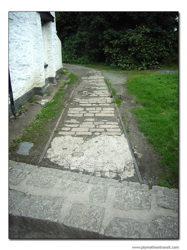
As you can see this bridge was a railway bridge which used to carry a line into a goods yard. Until fairly recently the metal tracks were evident on the bridge itself, but the bridge was becoming dangerous so the Council added extra wooden planks to create a new raised platform above the tracks, which I assume are still in place underneath this new plain surface.
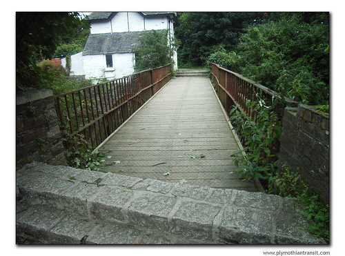
This is just one clue as to the industrial railway activity which was a feature of this area at one time. I am still investigating the path of the railways in this area which I will understand a lot more once I get my hands on the RA Cooke Track Guide for this section, as the Plymouth book I have stopping just before this point!
14 July 2008
Plymothian Bridges 043: Havelock Terrace
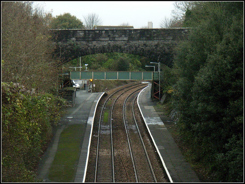
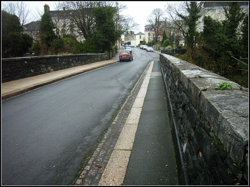
Taken from Devonport Road bridge featured yesterday this is looking back towards Devonport Station. The Havelock Terrace bridge actually goes over the station platforms. Pedestrian access to the station is from a pathway just off the left hand side of the bridge as we look at it from here. To get to the other side you have to use the footbridge as there is no access from the road on the right side of the road bridge.
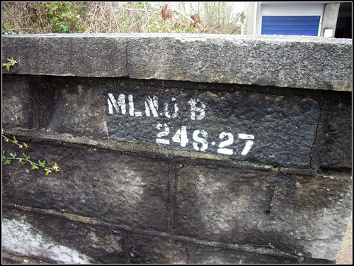
Another bridge with a painted bridge number

13 July 2008
Plymothian Bridges 042: Devonport Road
Is been a while since the last one so thought I'd better get on with the posting on Plymothian Bridges before I forget them completely.
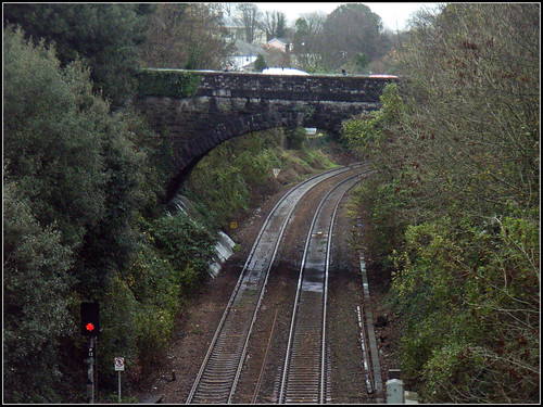
Devonport Road is the main road from Stoke Village down towards Devonport and is a very busy road. It also has this quite impressive brick built bridge over the main line. Devonport Station is just behind me as I take this photo from Havelock terrace.
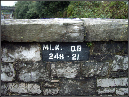
The bridge number
The other side of the bridge is really difficult to get on camera!
03 June 2008
Plymothian Bridges 041: Saltash Road
A few new photos of the new pedestrian footbridge over Saltash Road which replaced the one that got knocked over by a lorry a few years ago. I have not added this to the map yet as time is limited tonight (wife flies off to Florida in the morning!)
I was surprised to see that the old ramps up to the main footbridge have not been repainted which does rather take the shine off the smart new bridge. I assume that this is planned to be done in the near future as part of general maintenance.
26 May 2008
Plymothian Bridges 040: Garfield Terrace
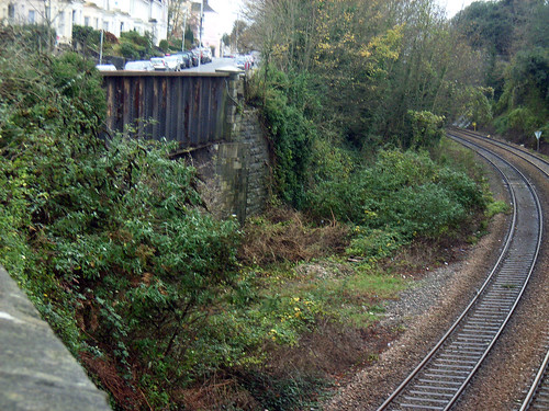
Now I know there isn't much to see in this photo, but you can just make out the metal sides to the road bridge over what used to be a line into a goods yard off the main line through Plymouth. The main line is still here but the goods yard has long gone.
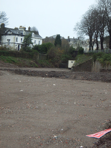
When I was last there it was impossible to get a good view from the other side as it was all closed off for the construction of a nice new, and probably quite bland housing estate. In the photo below you can see the site has been cleared and levelled ready for the building to start. The bridge itself is tucked in just behind the metal portable building in the middle right of the image.
As well as being a goods yard it was also a link between the two main lines through Plymouth as the bottom of the site was linked to the line into Devonport Station. This can be seen more clearly in this modified Google Map image with the green lines showing the old line into Devonport Station and the border of the goods yard itself. The bridge is shown top left by the red arrow. You can see that the Google image was taken after my own photos as construction is well underway. For years after the closure of the goods yard this site was some sort of builders merchant (I am sure it was something like that anyway!) I am still trying to work out the dates that the goods yard was closed. I am sure I will come back to this whole area again during the summer!

Full map...
Elsewhere on dbg today...
 Visit What the Penguin Likes for a run down on watching television on the Internet.
14 May 2008
Shakey Bridge
Work has started on Weston Mill viaduct, to renew its 109-year-old structure. Network Rail is investing £4 million on the nine-month project, which will improve the condition of the viaduct, also known as the 'Shakey Bridge'. Repairs will be made to the steelwork and brickwork to strengthen its structure and extend its life for another 50 years, and the bridge over the viaduct will also be repainted to protect it from corrosion. At 46 feet high and 1,200 feet long, the Weston Mill viaduct was a replacement for an all-timber structure that was originally designed by Brunel.
I do hope that this refit will include the reinstatement of the footpath that runs alongside the railbridge. It used to save a long detour around Camels Head and was also a good fun experience when a train came across - hence the name Shakey bridge.
I have fond memories of racing buses along this path. You had the challenge of getting off a bus at HMS Drake and then racing it to the other side of the bridge at St Budeaux! In those days Camels Head was a major bottleneck where two lanes of traffic merged into one. It was a tall order if traffic wasn't too bad though, and the conductor would often wave at you as he went passed if you didn't quite make it to the bus stop! Occasionally though traffic was so bad that you could get off one number 6 or 7, run across the bridge, and end up catching the previous 6 or 7 supposedly 15 minutes down the road!
Happy times, especially as the buses were Bristol FLFs!
03 May 2008
New Bridge Saltash Road Plymouth
Today was an important day in Plymouth. Well maybe that was a slight exaggeration but it was the day that the pedestrian link by Plymouth Railway Station was finally opened to pedestrians. It was replaced last Sunday after having been demolished by a 'cherry picker' on the back of a transporter two years ago. (19th July 2006 to be exact) It was one of those news stories which seem to defy all belief. The bridge was knocked down in the rush hour on one of the main routes into Plymouth - and no one was hurt! More details from the original post here
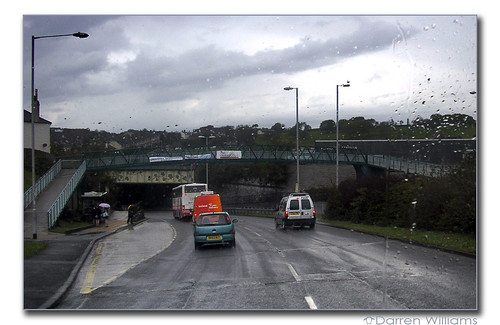
Thanks to Darren Williams for sending me a couple of photos of the new bridge in situ.
01 May 2008
Plymothian Bridges 039: Devonport Tunnel
As promised bridge number 39 is indeed right next to bridge 38.
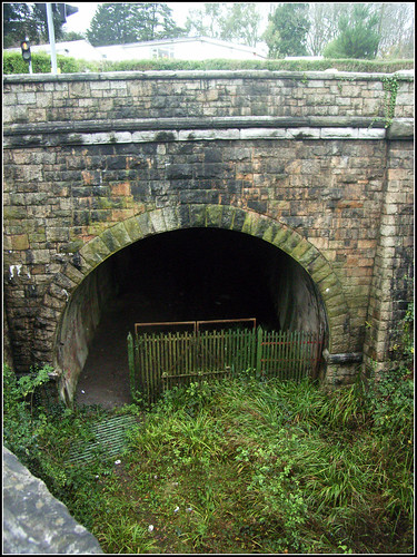
This is the entrance into Devonport Tunnel which took the railway underneath Devonport Park and Stoke. It actually passes a few feet underneath the other tunnel which takes the existing line under Albert Road. The tunnel is now closed off, although it seems the gate was down when i took this photo a few months ago.
It used to really annoy me that this tunnel was closed. I used to live in Ford, right next to the large viaduct which crossed the Levans Valley. Had the bridge and tunnel been open I could have cycled to college here, all on the level. Instead I had to cycle up and down the steepest roads in Plymouth!
I am still reading up on the railways of Plymouth as there are many gaps in my knowledge but hopefully I will be able to put a lot more detail to some of these posts in future!
27 April 2008
Plymothian Bridges 038: Paradise Road
The last bridge saw the main line sweep into Devonport Kings Road Station. This far less impressive bridge carries the same road over the line out of the station as it heads West towards the Tamar.
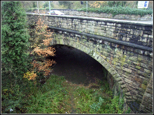
It is now just an overgrown area of weeds, and usually a pretty damp and almost swampy area.
Bridge 38 lies just beyond this one and is much more impressive - but you have to wait for that one!
10 April 2008
Plymothian Bridges 037: Paradise Road
Slowly following the line as it works its way into the old Devonport Kings Road Station we find ourselves faced with this wonderful brick built road bridge. Sadly I never knew this are when the trains ran but it must have been a great sight watching all the steam trains pass under this bridge into the station.
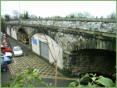
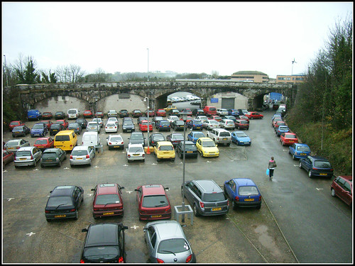
Of the five spans three are now bricked in as extra storage areas leaving just the two through roadways as access to the car park serving the college on the other side of the bridge.
14 March 2008
Plymothian Bridges 036: Waterloo Street
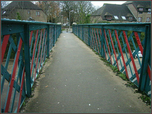
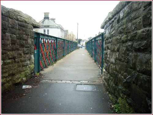
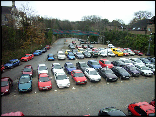
This fine ornate cast iron pedestrian bridge must have been a great place for trainspotters! Although it now just provides a short cut over a dull car park, it used to be over the main railway lines as they entered Devonport Kings Road Station.
09 March 2008
Plymothian Bridges 035: Fitzroy Road
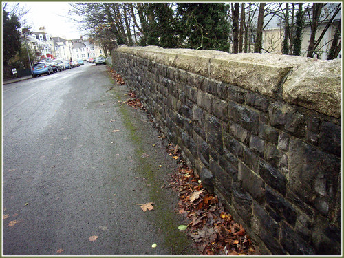
Its been a while since the last bridge in the series so there will be a few this week - all pretty close to each other and connected to the railway which used to run into the old Devonport Station. The brick wall above is one of the better shots I could get of this bridge. We are standing on Fitzroy Road which runs into Valletort Road just a bit further down the hill. The railway ran into Devonport Station which is to the right. The railway cutting has been filled in on the left hand side of this shot.
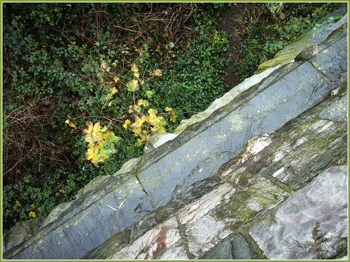
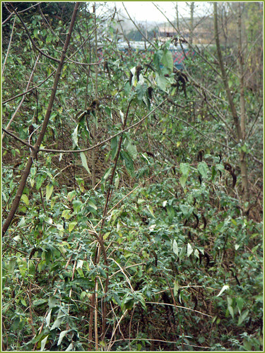
This is the view looking down over the wall and you can see how overgrown the area is. This section of the railway cutting is out of use and just seem to have turned back into jungle!
In the distance in this lower shot you can just see the next bridge in the series from where I took the next photo...
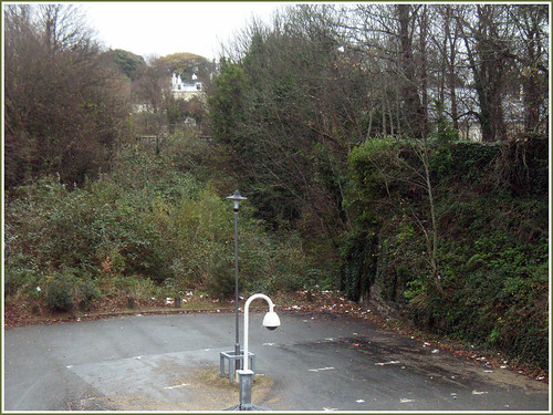
The car park here is part of the College of Further Education. You can just see the Fitzroy bridge through the trees.
21 January 2008
Plymothian Bridges 34: Molesworth Road
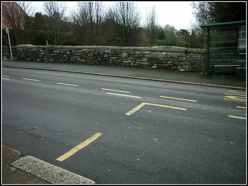
I promised you another bridge from Molesworth Road and this is it! Actually from this angle it does look a bit like a bridge. Its only when you get up a bit closer and look down over the bridge walls that you see this...
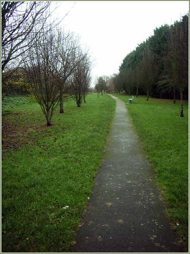
The cutting that used to contain the old railway line through to Devonport Station (now the College of Further Education) has been filled in and turned into this small garden area.
All trace of the bridge on the other side of the road has been removed as a new Nursing Home has been built on the site.

Subscribe to:
Posts (Atom)