Showing posts with label Development. Show all posts

02 June 2026

North Cornwall Connection Feasibility

This sounds like a good idea - but will it ever happen? 


A study into whether a multibillion-pound rail link through Cornwall would work has been hailed as a "huge step forward" by campaigners.


They said the proposed line would link Okehampton, in Devon, to Launceston, continuing onto a new station near Bodmin and joining the existing Cornish mainline.


Cornwall Council said it would now look at a more detailed study into the scheme - admitting it had the potential to improve rail resilience and open up the opportunity for more freight trains.


However, it warned the railway would be unlikely to be in use until the 2040s at the earliest.


David Hill, Smith, a railway engineer who worked on HS1 and an advisor to campaign group Connect North Cornwall, said the "obvious" route for the new railway was alongside the A30 from Okehampton.


"We would keep north of the A30, we wouldn't use the Meldon Viaduct, follow the A30 to Liftondown, and there would be a viaduct across the Tamar," he explained.


He said land at Scarne could be a potential site for a new station.


"It's next to the new development, the industrial and commercial areas of Pennygillam, and the junction of the A30 so it would be an ideal location potentially for a freight terminal," he observed.


Hill-Smith welcomed the council's backing of a feasibility study: "A proper study will add credibility. That will be a huge step forward."


He admitted the whole scheme would cost billions - but extending the route to Bodmin and Truro would make it more economically viable.


Councillor Leigh Frost, the Liberal Democrat leader of Cornwall Council, said it was a project which "had legs" and could allow more freight trains to boost the area's critical minerals industry.


"We can't use freight at the minute to get out of Cornwall on the current line. It's just not suitable.


"If we have that freight line that's running that takes around 129 HGVs off the road.


"We need to work out what barriers or what the opportunities are to deliver that and also how much is it going to cost - then hopefully the government will go this is a project that's worth delivering and we'll invest in that."


However, he cautioned it was unlikely to be delivered until the 2040s at the earliest: "If you don't start that work now, tomorrow doesn't come. You've got to have these plans in place and be ready to jump when the funding becomes available." 


Bodmin Parkway is currently the only station serving the north of Cornwall - with the previous station at Launceston having closed in 1967.


Connect North Cornwall said creating a new electrified line through the town could enable journey times between London and Truro to be cut to two-and-half hours.


Ben Maguire, the Liberal Democrat MP for North Cornwall, said he would be meeting the rail minister, Lord Hendy, to discuss the plan.


"This is a really exciting project. It would massively boost our economy. It's the kind of project on a par with Northern Powerhouse Rail or HS2.


"We have dismal journey times and don't have the capacity to take large quantities of freight. This would avoid the resilience issues that we face at Dawlish," he added.


BBC NEWS

2040_North_Cornwall_Rail_Vision


28 October 2022

Mayflower Street Improvements

Planned improvements to bus facilities in the city centre look set to start next week.

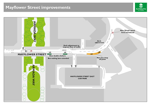
New bus shelters will be installed at the bus stops on Mayflower Street, which will be widened to improve traffic flow.

More space is going to be created for the buses to use. The scheme will see:

  • A new bus stopping area with extra space to drop off passengers
  • There are currently two bus stops and one shelter. The new scheme will have two bus shelters and bus stops with space for three buses
  • Kerb adjusted to widen the road so that buses and cars can pass by when other buses have stopped
  • Street furniture removed if surplus and relocated where necessary
  • Disabled bay relocated – with details to be confirmed later
  • Eight car parking spaces removed.

Mayflower Street Simple Plan The work is being carried out to create more bus stops in the city centre ahead of major changes to the layout of Royal Parade. Some bus services – yet to be decided – will be moved to Mayflower Street permanently rather than Royal Parade to create more space and cut congestion on Royal Parade. It should also help improve air quality as fewer buses will be queuing for space.

These improvements are funded by the Department for Transport’s Transforming Cities Fund which is costing £615,000.

Traffic orders have been submitted for when the work is carried out as well as changes to traffic management after the work.

The enabling works get underway from Tuesday 1 November to 11 November and will see trenching for Western Power electricity diversions under two-way traffic lights. Four car parking spaces will be removed and the disabled parking space relocated to the end of the remaining parking spaces opposite The Early Bird.The work will be carried out in five phases

Councillor Jonathan Drean, Cabinet Member for Transport said: “We are talking to the City Centre Company, businesses – including the Copthorne Hotel – about the plans and hope to work with them on any issues they raise.

“Plymouth has pledged to be carbon neutral by 2030 so we need to encourage more people to get out of their cars and use public transport when travelling to and from the city centre. This work once complete will help alleviate congestion on Royal Parade as well as emissions build up as fewer buses will be using the bays on Royal Parade.

“We recognise that all these changes are coming in a relatively short period of time. Much of the timing is beyond our control – we’ve had a combination of the pandemic, supply issues and tight government funding time tables which means we have to do a lot of projects in the next six months or so. These changes will be worth it.”

Full article: https://www.plymouth.gov.uk/improvements-bus-facilities-mayflower-street

Library copy

Plymouth Citybus are diverting a few of their services:

SWH will be undertaking essential highway improvement works on Mayflower Street and surrounding junctions, on behalf of Plymouth City Council. The Mayflower Street Improvement Scheme will commence on Tuesday 1st November 2022 with a provisional completion date of Friday 19th May 2023.

During these works, there will be a number of diversions in place, as follows:

Bus services towards the City Centre from North Hill and Charles Street will operate via Cobourg Street, North Cross and Western Approach.

Passengers will be able to use the bus stop on Cobourg Street (closest) or at the other end of Mayflower Street as alternative stops.

Service 61 heading towards Mayflower Street/City Centre from Pennycomequick/Saltash Road Rail Station will operate via North Cross Roundabout and Western Approach to Royal Parade.

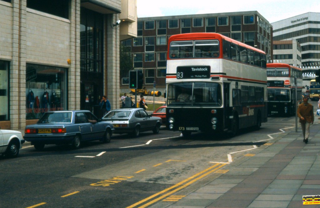
PCB Leyland Olympian 173 - Ply., Mayflower St - 1988

©Jos Van Hemert

Mayflower Street 1988!

08 August 2019

Eastern Corridor Junction Improvements

Plymouth City Council give warnings of more roadworks starting soon. This is bound to have an impact on congestion while the works are underway…

Junction improvements in the east of Plymouth will continue next month with work on Plymouth Road.

The work will mark the next stage of the Eastern Corridor Junction Improvement Scheme and follows on from work already completed at the Cot Hill and Merafield Road junction earlier in the year.

Now, the focus will be on Plymouth Road itself with ageing traffic signal equipment set to be replaced with the latest technology and footways, crossings and cycle paths improved. Crucially, the scheme will also see road capacity increased.

Contractor South West Highways will begin work on Monday 2 September and will be completed in Summer 2020.

Councillor Mark Coker, Cabinet member for Strategic Planning and Infrastructure, said: “We know how important this scheme is to the people who live in the east of the city so I’m delighted that we’re in a position to move on to main section of the work.

What’s happening on Plymouth Road?

A major part of the scheme is an extension to the eastbound, right-turn lane at Cot Hill where the road will be widened, reducing queues at this junction.

At Marsh Mills, an extra lane will be added to the entry of the roundabout for traffic accessing the A38, with upgrades to the crossing facilities and signals.

Meanwhile, Coypool Road and Larkham Lane will be changed to a two lane exit, allowing more vehicles to flow onto Plymouth Road in a shorter green light window.

New crossing facilities at Woodford Avenue and Larkham Lane are also in the plans, as are upgrades to crossings at Dingle Road and Glen Road and a new cycle lane between Larkham Lane and Dingle Road.

Which part are you doing first?

The first junction to be tackled is Marsh Mills, where lane closures will be in place for two months to allow for works for a new lane to be created and for new lights to be installed. These lane closures will be off-peak only.

At the same time, new crossings will be installed at Larkham Lane. Again, a lane closure will be necessary while these works are being completed. They are expected to finish in February next year.

Timings for works on the other junctions will be released as the scheme progresses.


eSocial Media Highlights…


04 July 2019

Railway Station Masterplan Consultation

Plymouth’s rail commuters are getting the big picture of the city’s exciting plans to create a better welcome for rail passengers.

A masterplan is on show at the station today (Tuesday) and gives a bird’s eye view of what buildings could be going up, what’s coming down and how this vital entrance to Plymouth could look in the future.

Key partners in the city are working together to create a whole new feel to this important gateway for people arriving into the city by rail – from Cornwall as well as Devon and beyond.

The University of Plymouth recently showcased by way of a public consultation, its exciting ambition to transform the tower above the station into Intercity Place. This will house inter-professional clinical skills and nursing/midwifery facilities as well as additional educational services to support the future health workforce. Subject to planning permission being granted, it will signal the first major work to rejuvenate the station and its surrounds as the anchor investor.

Now commuters can see more detail of what’s in store as the regeneration scheme moves off architects’ drawing boards and into the planning system.

Council leader Tudor Evans said: “This is a massive regeneration scheme involving key organisations in Plymouth all committed to creating a real sense of arrival – a wow – when people come here by train.

“It’s a hugely complicated scheme with lots of different elements. The university’s vision for the tower means we have an anchor tenant but we now want to know the initial thoughts of those who use the station the most.”

The masterplan would become the guiding document for decisions being taken around this location. Plans currently include demolishing the redundant rail incident safety centre (RISC building) on the east side of the station to enable a new multi-storey car park to be built.

The existing car park opposite the entrance is also earmarked for demolition and a new hotel and second university building created in its place. The masterplan proposes a new car park, almost doubling the capacity to 469 spaces, for the site of the RISC building.

Station staff accommodation will be modernised and significant new public space created including a direct pedestrian link to North Cross and the city centre.

University of Plymouth Vice-Chancellor Professor Judith Petts CBE said: “This forms an important part of the University’s ambitious estate plans which will transform the campus and reimagine university teaching and research spaces for the 21st century. The station scheme is an important part of these plans and will significantly improve this notable city landmark so that it becomes an exciting gateway into Plymouth. As a new home for allied health professions and nursing/midwifery, this builds on our already strong health credentials by making a significant investment in educating tomorrow’s health professionals for the region and beyond.”

GWR Plymouth Station Manager Sara Rogers said: “There are almost 2.5 million passenger journeys through Plymouth every year, and it is easy to see why the station is regarded as the gateway to the South West. New Intercity Express Trains, providing almost 25 per cent more seats on every train than the ones they have replaced are already in service, and from December this year we will see more frequent and faster journeys. In keeping with improved services, I am delighted rail users will now have the opportunity to see these upgrade plans and the next phase in the station’s development.”

The entire scheme is expected to cost in the region of £80 million and has already received some financial support. Through the One Public Estate, the Cabinet Office has provided £500,000 for feasibility and planning work.

The City Council invites you to view the draft Concept Masterplan and Public Realm Delivery Plan and provide your feedback on the proposals.  The masterplan will then be finalised and adopted as a Planning Statement by the City Council for use in preparing and determining future planning applications.

Full details of the masterplan are provided in the accompanying documents which are available to view below:

The closing date for the receipt of responses is Sunday 21st July 2019.


Plymothian Transit Library:

11 June 2019

Plymouth Railway Station Redevelopment

Back in October 2017 The Herald ran a nice little piece on Plymouth Railway Station which included some great photos

North Road Station was given a major makeover in the early 1960s, and, hot on the heels of the Civic Centre opening, which at the time was Plymouth’s tallest building, we had the opening of a second new city ‘skyscraper’ at the railway station

and ended with The HUGE plan for the future of Plymouth Railway Station

Land at and surrounding the railway station has been allocated for a mixed-use regeneration scheme to create a high quality gateway and arrival point to the city and increases the capacity of the station to accommodate increasing numbers of passengers. But it won’t just be a station. There will also be offices, education facilities, commercial, hotel, small-scale retail development, residential and student accommodation.

The Plymouth 'skyscraper' which you probably drive past without realising (its worth a read with some great photos!)

We then move to 8th February 2018 “Eight major Plymouth building projects,and when they are set to begin and finish

A whopping £205million worth of developments are set to change the face of Plymouth over the next two years – and here is when the city can expect to see things happen.

Plymouth Railway Station – work starts in 2019

The council is pumping £5million from its capital budget towards a £40million overhaul of the North Road station site. The local authority has been working with Great Western Railway, Network Rail and Plymouth City Council on plans which envision the Intercity House office Office block being refurbished – or even knocked down – and escalators carrying passengers right up to North Cross. ““I’m confident we will be on site in 2019.” New Station for Plymouth?
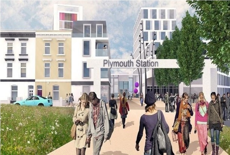
Jump to 17th May 2018 and the Herald: Plymouth's Railway Station and the £100 million pound question

It is understood the project is not under threat – with the council having already pledged £5million – but the Government is looking at ways of paying for it and so is pitching it abroad.  The Plymouth project is earmarked for demolition to begin in 2019 with a view to having the huge scheme finished by 2021, the Government says

By the 4th September 2018 it looks like things could be starting:

Demolition to begin in £100m railway station revamp The first significant steps are being taken on the £100million revamp of Plymouth’s railway station with plans to upgrade the concourse and knock down buildings to make way for a new car park. Plymouth City Council’s Cabinet being asked to approve a £26million funding package – when it meets on September 11, 2018 – which will facilitate a phased upgrade to the station concourse and customer facilities.  Cabinet will discuss demolishing the Rail Incident Safety Centre (RISC) building on the east side of the railway station to enable a new multi-storey car park to be built.

Tudor Evans, Leader of Plymouth City Council, said: “This kick-starts a pledge we made to Plymouth in May: that we would deliver a new gateway to Plymouth at the train station with a new entrance overlooking the city, a new car park and more spaces for business and retail.

First images reveal Plymouth's train station of the future (17th September 2018)

Plans to improve the city’s welcome for rail passengers and regenerate the area around the station are moving forward now the council has  given approval for a £26million funding package. Under the first phase of the ambitious regeneration plans, GWR, working with the council and Network Rail, will work on a phased upgrade to the station concourse and customer facilities around it.

  • Demolishing the rail incident safety centre (RISC building) on the east side of the railway station to enable a new multi-storey car park to be built.
  • By 2021 a new 469-space car park will be built on the site of the RISC building with almost double the capacity of the existing car park.
  • Modernised station staff accommodation.
  • Public space works including a direct pedestrian link to North Cross and the city centre.
  • A new-look entrance off North Cross will also massively improve the pedestrian access to the station.
  • Potential for a new hotel and gateway development on the site of the existing car park, which will be demolished once the new one is completed.
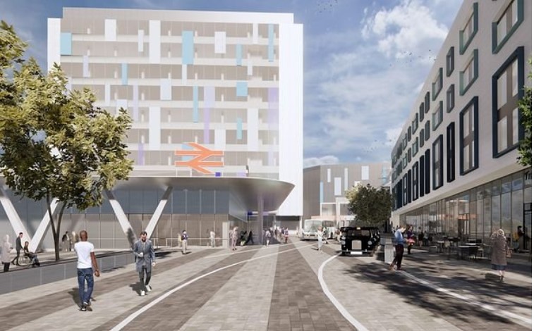
Plymouth Station

Plymouth's multi-million-pound transport plan for roads, rail, cycling and more 2 October 2018

Plymouth is being invited to bid for a share of millions of pounds of Government cash to improve transport. The city council says it can now work up details of a package a measures, including a key part to upgrade Plymouth Railway Station.

The council says being shortlisted means that it will work with partners to work up the detail of the sustainable transport schemes with the Department for Transport and the consortium of partners that developed the bid

BY May 2019 detail is starting to emerge on the tower block itself

Plans to turn ugly train station building into student nursing hub

The University of Plymouth has plans to turn Intercity House, which stands behind Plymouth Railway Station, into a student nursing and midwifery hub.  A pre-planning application submitted to the council states that if the proposal is accepted, the building will become know as Intercity Place and will see a change of use from offices to academic facilities.

"We’ve started a journey to completely transform the station to create a better sense of arrival. With public transport playing a huge role in tackling climate change, this journey is more important than ever.

"MICA’s design transforms the 10-storey station building with a new gleaming bronze anodised, pleated façade that supports a low energy strategy for the high performing academic building.”

We now bring the story right up to date:

Plymouth station tower to become uni block as part of £100m scheme

Plymouth’s towering but dilapidated railway station skyscraper is to be redeveloped and turned into a university campus for training health professionals - also giving the city a new gateway as part of a £100mllion project The redevelopment, masterminded by the University of Plymouth, would make a major difference to one of Plymouth’s key gateways and is part of a much wider plan for the nearby university campus and the railway station concourse and land in between the two.

But most prominent for the city will be the creation of a glazed top floor viewing room, and possibly a “sky café”, which will act as a “beacon” at night for the city. And an illuminated “halo” of LED lighting on the roof will also make the tower stand out at night and act as a landmark for the city.

“Hopefully we will be able to start work in July or August with a soft strip and maybe erect scaffoldings, but work will mainly commence later  this year and complete in February 2021.” Plymouth Station Tower

Like with most large scale developments promised / planned in Plymouth, this has been a long time coming but finally its looking like it really is about to start happening soon. What do people think? Plymouth Station HST
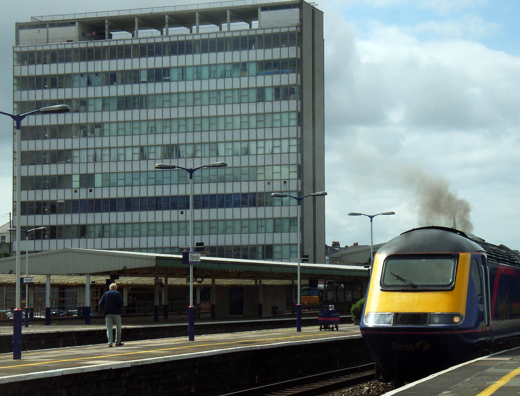
© did by graham: Two icons of the Plymouth Railway scene!

04 July 2018

Mannamead Mayhem?

Another major traffic improvement scheme is about to start in Plymouth. Although in the long run this should improve traffic flow and help the buses, it will mean more delays while the work is underway…

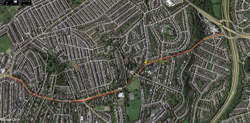
The Mannamead Road Junction Improvement Scheme is set to get underway.

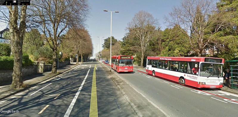
Modern and efficient signals will be installed at a number of junctions along the route with the aim of reducing traffic delays between Torr Lane and Mutley Plain, reducing journey times for motorists and improving service reliability for buses.

As well as replacing worn out and outdated traffic signals, the scheme will also address road safety with upgrades to pedestrian crossings and by providing better facilities for cyclists.

Work is due to begin on Wednesday 18 July and is expected to last for around five months. Mannamead

Councillor Mark Coker, Cabinet Member for Strategic Planning and Infrastructure said: “This is a key road for people who are travelling into both the city centre and the district centre at Mutley Plain from the north and the A38. It is crucial to keep traffic flowing and support greener travel as Plymouth continues to grow.

“These improvements will reduce queueing, particularly during the morning and evening rush hours and make it safer and easier for people to walk and cycle along this busy road.”

As part of the scheme, the layout of the junction of Torr Lane and Mannamead Road will be improved and new Toucan pedestrian and cycle crossings provided. A new off-road shared pedestrian and cycle lane between Torr Lane and the Manadon junction will also be provided.

Meanwhile, 13 on-street parking spaces, which are currently restricting traffic flow on the approach to Mutley Plain, will be removed.

Eight replacement spaces will be provided, split between College Avenue and Connaught Avenue, while Mutley Barracks car park will be free for the first hour during the day and also from 8pm every night.

The main construction work will take place between 7.30am and 6pm, Monday to Friday, and on the occasional Saturday morning between 7.30am and 1pm.

Work will start at the Torr Lane junction before moving onto the junctions further south. However it should be noted that works will be taking place along the length of Mannamead Road (and in particular between Torr Lane and Seymour Road) throughout the construction period.

Whilst every effort will be made to keep disruption to a minimum whilst work is taking place, temporary three-way lights will be required at various locations throughout the construction period to allow the existing signals to be replaced. Every effort will be made to have only one set of temporary lights in operation at a time and they will be manually operated during busy times of day to minimise disruption.

The southbound bus lane from Russell Avenue to Torr Lane will be closed from late September for around one month. The northbound bus lane from Whiteford Road to Hartley Road will be closed from late August for around three months. It is expected that all bus stops on Mannamead Road will remain open throughout the works. manna1

It will also be necessary to close the entrance and exit of Torr Lane, at its junction with Mannamead Road, between 9.30am and 3.30pm, for three days at the end of September. Suitable diversions will be in place during this closure.

Regular users of this route are advised to plan ahead and allow extra time for their journey.

The scheme is estimated to cost around £1.7 million, with over £1 million being provided by the Heart of the South West Local Enterprise Partnership.

It is part of a masterplan of highway improvements that will help unlock development and help deliver new jobs and homes in the north of the city, complementing other transport schemes along the Northern Corridor including the recently completed Outland Road Junction Improvement Scheme and Derriford Transport Scheme.

For more information on the scheme including traffic management, visit the Mannamead Road Junction Improvement Scheme page. In the event that the programme changes due to unforeseen circumstance, updates will be published there and on the Council’s Facebook and Twitter pages.

You can also sign up to receive the Council’s weekly roadworks roundup. Notices will also be placed on site in advance detailing any closure, restriction or diversion and will also be advertised in the local press.

The post Main work set to start on Mannamead Road junction improvements appeared first on Plymouth News Room.


11 January 2018

Derriford Developments

Some welcome news of more road developments at Derriford Hospital:

Work on a new bus link to Derriford Hospital will begin in spring 2019.

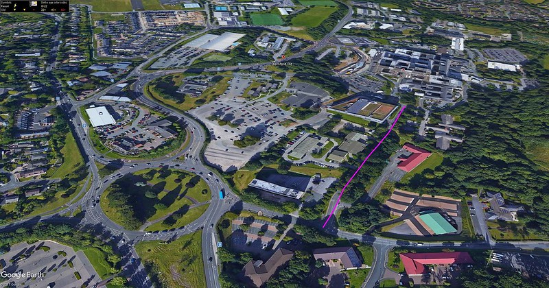
The Morlaix Drive Access Improvement and Bus Priority Scheme will widen Morlaix Drive between Brest Road and the hospital to provide improved access for public transport, pedestrians and cyclists. morlaix

The road to be widened highlighted by the pink line

Funding for the £4.7 million project will be part-funded by £3.3 million awarded to the council by the Department for Transport in October.

Councillor Patrick Nicholson, Deputy Leader and Cabinet Member for Strategic Transport and Planning, said: “This scheme is a critical piece of the public transport network and part of a package of transport infrastructure improvements aimed at increasing connectivity in the north of the city, particularly by more sustainable means of travel.

“The Morlaix Drive scheme will support increased travel by bus, helping to ensure that the additional travel demand from new housing and employment sites in the Derriford area is catered for, keeping the city moving as it grows and expands.”

Complementing the larger Derriford Transport Scheme, the improvements will enable buses to serve Derriford Hospital and the upgraded bus interchange area at the front of the hospital without using Derriford roundabout and Derriford Road.

This will support improved reliability of buses in the area and provide benefits for traffic using Tavistock Road. It will also maximise the benefits of the recent Marjon Link Road bus link.

Scheme designs are currently being worked up and public consultation will take place later in the year before final designs are agreed. Work is expected to begin in spring 2019.

This decision has been made under delegated authority and is subject to call in by scrutiny.

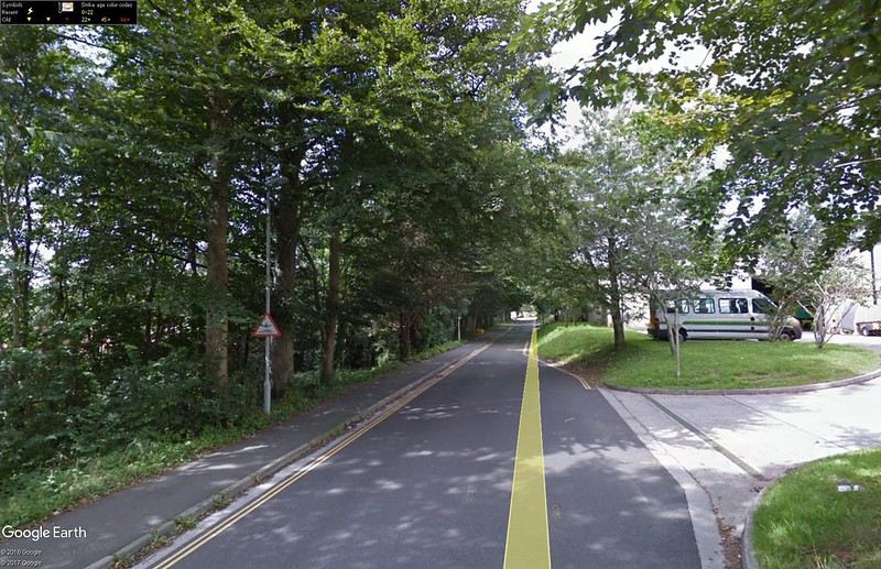
narrow

The Google Street view image above illustrates one of the big issues with this road currently - there is a very narrow bit which does not allow two way traffic and its right outside the ambulance station too! Drainage is also very poor along this road so its not a pleasant walk when its wet. As a short cut out from the hospital for buses this will save a lot of time and perhaps more importantly be great for me as I work down at the end of this road - hopefully will save me a walk from the hospital each day!

23 February 2017

Woolwell and Outland Road

Catching up with some Plymouth City Council news…

Bottleneck

Plans to tackle one of Plymouth’s worst traffic bottlenecks have been given the green light.

We have allocated £420,000 for design work on a scheme to alleviate congestion at the notorious pinch point between Woolwell Roundabout and The George. We have also committed more than £15 million in its capital budget to deliver the scheme, which will help reduce congestion along the A386 Tavistock Road and support proposed new developments in the north of the city. We are exploring options to widen the road between Woolwell Roundabout and The George and provide two lanes in each direction, removing the need to merge and reducing journey times for everyone. The scheme will also include plans to upgrade the junction with Woolwell Road, as well as improved public transport, walking and cycling links.

The Plymouth and South West Devon Joint Local Plan, due to be published later this month, identifies Derriford and the northern corridor as one of three strategic growth areas where most of the planned growth in the city will take place through to 2034. The vision for this area is that it will be transformed to create a high quality, distinctive, vibrant, mixed-use new heart for Plymouth. The vision supports major investments and radical improvements in transport infrastructure and the Woolwell to the George project is the flagship infrastructure project as part of this.

Plymouth City Council George Woolwell

Plan

An ambitious plan for what Plymouth and South West Devon could be like in 2034 covering important issues like health, transport, homes, jobs and the economy, green spaces and infrastructure is to be considered by three councils next week.

The Plymouth and South West Devon Joint Local Plan is going to the Full Council in each local authority on the following days:

• Plymouth – Monday 27 February
• West Devon – Tuesday 28 February
• South Hams – Thursday 2 March

The Joint Local Plan is a culmination of months of planning and discussions between local communities, neighbouring councils, landowners, businesses and developers, interested in shaping the future of the area.

Councillor Patrick Nicholson, Deputy Leader and Cabinet Member for Strategic Housing, Transport, and Planning said: “This plan is vital for the future success of Plymouth, West Devon and South Hams. We have planned for the new homes and jobs that we need so that the area can thrive. A huge amount of work has gone on behind the scenes to take on board as many different views as possible. Here in Plymouth we’ve made huge efforts to strike the right balance between the need for growth and protecting our important green spaces for generations to come.

All three councils will be asked to agree that the Joint Local Plan is ready to submit to an independent Government Planning Inspector and if approved, a final consultation will get underway and will run from 15 March to 26 April 2017. This will be the last chance for the public to comment on the Joint Local Plan before it is formally submitted for examination. At this stage, the public and other interested organisations will be able to make comments but these need to relate to the soundness of the plan.

For more information visit http://web.plymouth.gov.uk/plymouthplan

Outland Road

Work to improve a key junction on one of the busiest roads into the city is nearing completion.

The Outland Road Junction Improvement Scheme aims to reduce congestion between Peverell Park Road and Torr Lane, improving journey times for motorists and service reliability for buses on this busy route. It will also improve road safety by upgrading pedestrian crossings and providing new on-road cycle lanes.

The first phase of the scheme at Peverell Park Road was completed in March 2016. The main works between Torr Lane and Weston Park Road / Ham Drive junctions began construction in September 2016. The original programme had a completion date of March 2017 but the contractor uncovered poor ground conditions that resulted in the completion date extending by a few weeks. This was unfortunately unavoidable.

We are coming towards the end of the scheme and aim to have the improved junction at Torr Lane reopened next week, which will alleviate much of the disruption to local residents and businesses. The current closure of Weston Park Road is also due to be lifted at the end of this week. From next week there will be a westbound closure of Ham Drive between Outland Road and Camilla Terrace, which will be in place for a maximum of three to four weeks. As with all the road closures so far, signed diversions will be in place for both motorists and pedestrians.

The diversions are essential in order for the works to be carried out safely, with the minimum amount of disruption to all road users. With a scheme of this size, at such a sensitive location, it is not possible to provide improvements without some delays being experienced. However we are trying to keep these to a minimum as far as possible.

Although there has been some weekend and night working to reduce the length of the construction period, this is disruptive to those living close by and the associated costs are substantial.

We work closely with the contractor, Amey LG, to ensure the scheme is delivered as far as is possible within the programme timescales and budget. Although there has inevitably been some disruption, the scheme will have significant benefits for the city in terms of providing better transport facilities for the future outland

09 November 2016

What a difference at Derriford


25th May 2016

Derriford Works Derriford Works

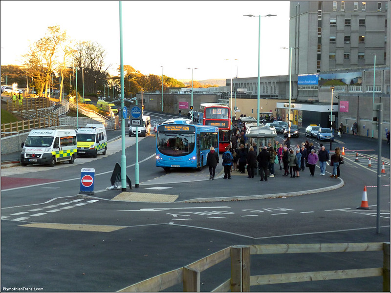
7th November 2016 Derriford Works

Most of the work has now been completed. The new drop off zone the right has opened this week. Where the ambulances can be seen on the left are the new bus stops which will soon be used by buses heading in the opposite direction. Since this photo was taken work has started on the new shelters. You can see how busy these stops get, so the sooner the new stops open up the better.

01 October 2016

Forder Valley Roundabout

From Plymouth City Council

We’re inviting people to share their views on proposals to improve the transport network in the Forder Valley area. Two schemes are being proposed: a new link road between William Prance Road in Derriford and the junction of Forder Valley Road and Novorossiysk Road and improvements to Forder Valley Roundabout.

The north of Plymouth is set grow significantly over the next 15 years. The Plymouth and South West Devon Joint Local Plan has identified this area to deliver 4,300 new homes and a new district centre providing new shops, community and leisure and health facilities. Key infrastructure, including the two Forder Valley schemes, will unlock this growth and help to provide major improvements for the north of the city.

The Forder Valley Roundabout improvements propose to extend the short merge from the roundabout heading northbound on Forder Valley Road for approximately 300 meters. The plans also include potential widening at the southbound approach to the roundabout and on the roundabout itself to allow for an additional traffic lane. The scheme will improve traffic flows as well as pedestrian crossing and walking and cycling facilities.

Capture


People will be able to view and comment on the plans at three consultation events:

Windsor House, Tavistock Road
Saturday 1 October, 10am to 2pm

Elm Community Centre, Leypark Drive
Tuesday 4 October, 10am to 7pm

Crownhill Library, Cross Park Road
Thursday 6 October, 3pm to 7pm

Council officers and members of the design team will be on hand to answer any queries.

The next step for the Forder Valley Link Road will be to develop a business case for approval by the Department for Transport, which has earmarked £22.5m towards the £33.5m scheme. If the plans are approved construction is expected to get under way around January 2018 and take around two years. Most of the construction will take place off the existing highway, minimising disruption.

The improvements at Forder Valley Roundabout are estimated to cost around £7.9 million and a bid for some of this funding has been submitted to Highways England.

30 September 2016

Forder Valley Link Road

This from Plymouth City Council:

We’re inviting people to share their views on proposals to improve the transport network in the Forder Valley area. Two schemes are being proposed: a new link road between William Prance Road in Derriford and the junction of Forder Valley Road and Novorossiysk Road and improvements to Forder Valley Roundabout.

The north of Plymouth is set grow significantly over the next 15 years. The Plymouth and South West Devon Joint Local Plan has identified this area to deliver 4,300 new homes and a new district centre providing new shops, community and leisure and health facilities. Key infrastructure, including the two Forder Valley schemes, will unlock this growth and help to provide major improvements for the north of the city.

The Forder Valley Link Road will reduce delays and unreliable journeys between the A38 and Derriford, providing an additional route from the east to the north avoiding the often heavily congested Manadon Roundabout and the A386 Tavistock Road. It will also provide essential infrastructure that will allow new developments in the Derriford area to come forward. The new link will make it easier to get to key destinations such as Derriford Hospital, the University of St Mark and St John and Plymouth Science Park, improve bus journey times and provide safer walking and cycling routes. It will also include a new area of recreational land, an extension of the nearby Local Nature Reserve and links from the new road to paths within the planned Derriford Community Park, connecting local residents and road users with the natural environment.

Forder Valley Link Road is a proposed one-kilometer road linking William Prance Road in Derriford and the junction of Forder Valley Road and Novorossiysk Road. The new link will reduce delays between the A38 and Derriford by providing an additional route from the east to the north of the city, avoiding the often heavily congested A38 at the Manadon junction and the A386 Tavistock Road. It will also improve accessibility for vehicles, buses, cyclists and pedestrians to key destinations such as Derriford Hospital, the University of St. Mark and St. John and the Plymouth Science Park.

The current preferred option includes a new link road, supported by a new bridge over Bircham Valley, with an enlarged signalised junction connecting it to the Forder Valley Road and Novorossiysk Road junction. This alternative route to Derriford will relieve congestion at Manadon, provide more reliability on the A386 Tavistock Road when incidents occur and offer more direct routes and improved journey times for buses from the east to the north of the city.

novo2

The relocated and enlarged junction as well as widening on Novorossiysk Road, to remove the existing merge south of the Miller Way (Asda) junction, will also reduce congestion and improve traffic flow.

Novo

The scheme will offer new walking and cycling facilities throughout, including an on-road cycle lane northbound on the uphill of the new link road, as well as a shared off-road facility to accommodate different types of cyclists travelling at different speeds due to the gradient of the hill. Segregated facilities will also be provided on the southbound section to provide greater separation between pedestrians and faster moving downhill cyclists. Other facilities will also be provided to link into all other approaches to the junction.

The scheme design includes providing recreational land for local residents to enjoy leisure opportunities, land to extend the local nature reserve and links from the new road to paths within the planned Derriford Community Park, connecting local residents and road users with the natural environment.

Subject to funding, construction of the Forder Valley Link Road is expected to get underway around January 2018, with delivery expected to take approximately two years.

Most of the construction will be undertaken away from the existing highway which will help to minimise disruption in this area during the construction period.

People will be able to view and comment on the plans at three consultation events:

  • Windsor House, Tavistock Road Saturday 1 October, 10am to 2pm

  • Elm Community Centre, Leypark Drive Tuesday 4 October, 10am to 7pm

  • Crownhill Library, Cross Park Road Thursday 6 October, 3pm to 7pm

Council officers and members of the design team will be on hand to answer any queries.

The next step for the Forder Valley Link Road will be to develop a business case for approval by the Department for Transport, which has earmarked £22.5m towards the £33.5m scheme. If the plans are approved construction is expected to get under way around January 2018 and take around two years. Most of the construction will take place off the existing highway, minimising disruption.

The improvements at Forder Valley Roundabout are estimated to cost around £7.9 million and a bid for some of this funding has been submitted to Highways England.


So what do people think?

 I personally think its a good scheme and will make a big difference to the area. The building of this will cause some serious disruption but I think it will be worth it in the long run and open up the Bircham Valley. I live a few hundred yards from the new Forder Valley Junction so will keep a close eye on proceedings and hopefully follow the construction as it happens.

(I must get down there and start taking some ‘before’ pictures)

04 August 2016

Derriford Developments

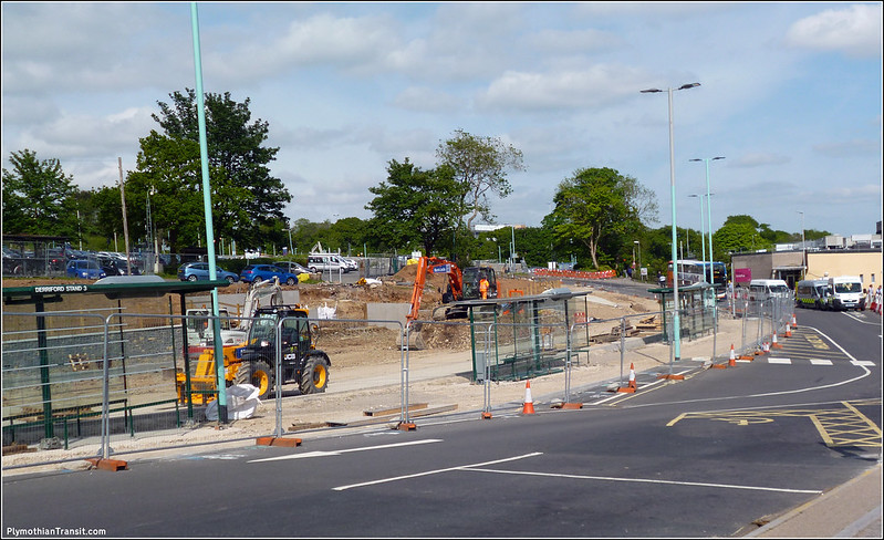
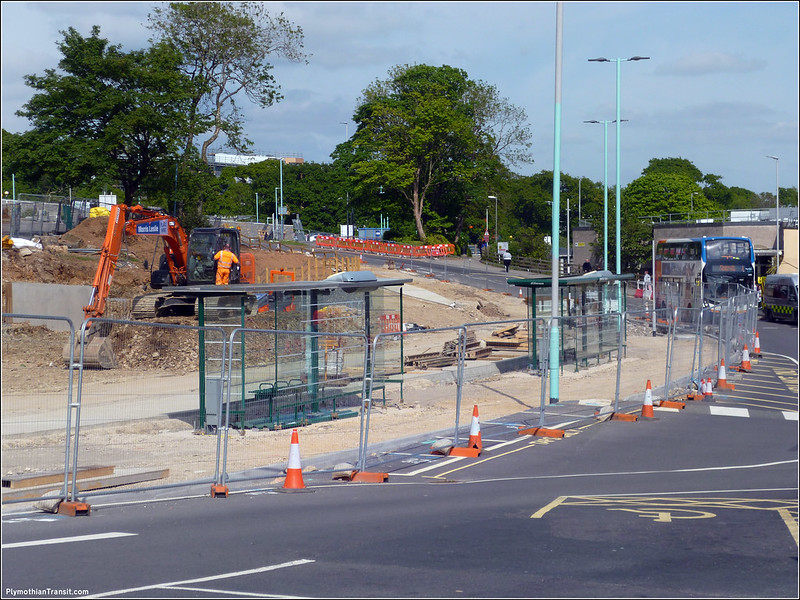
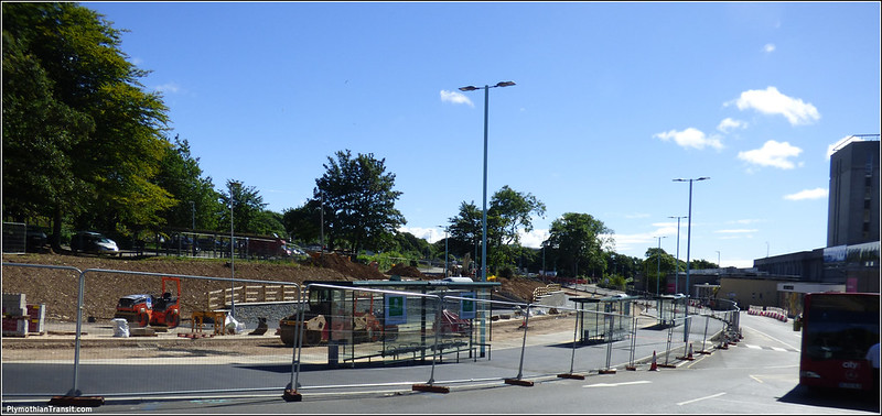
The major road works at the front of Derriford Hospital have continued for several months remodelling the road layout and providing more bus stops. The first few photos were taken back on the 17th July where the new bus road was more or less complete and the final road surface was being laid, giving a good idea of the new layout…

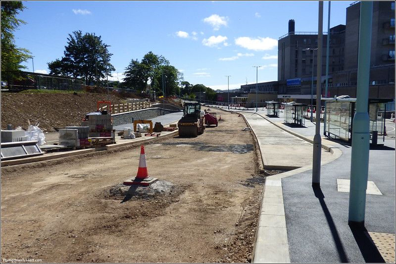
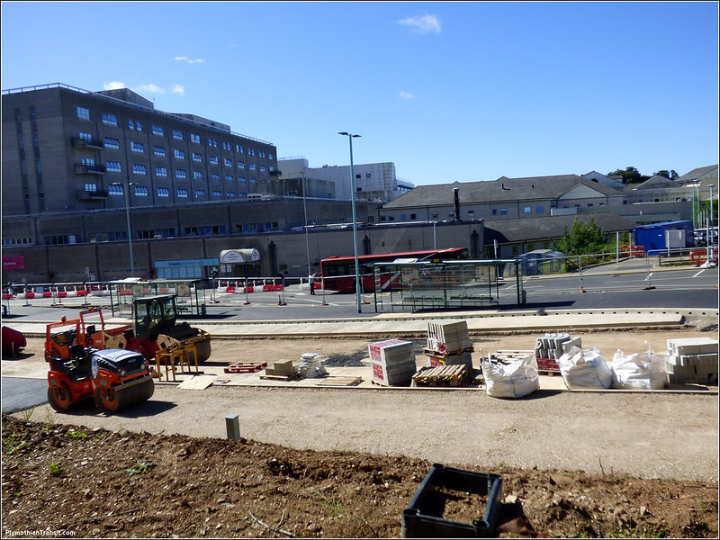
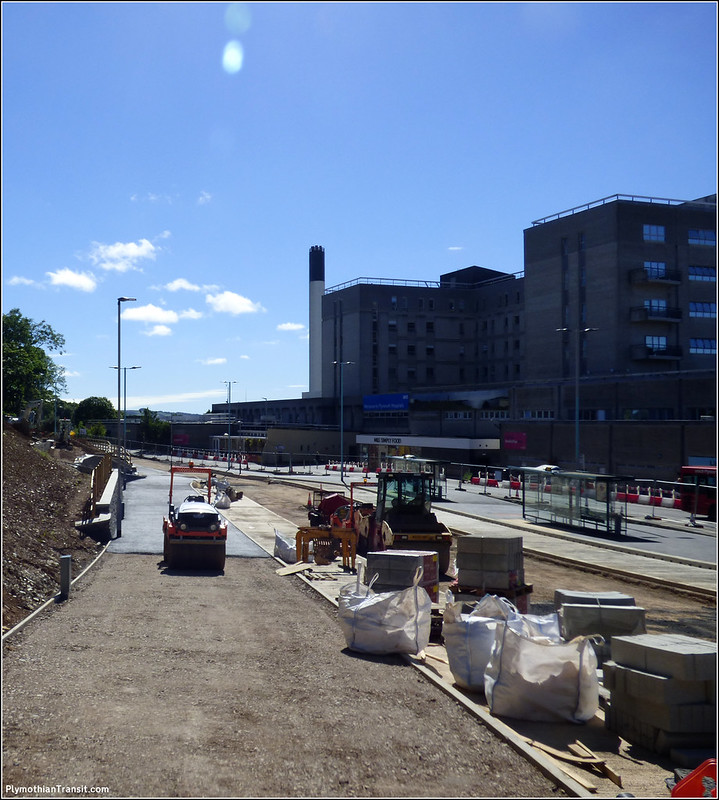
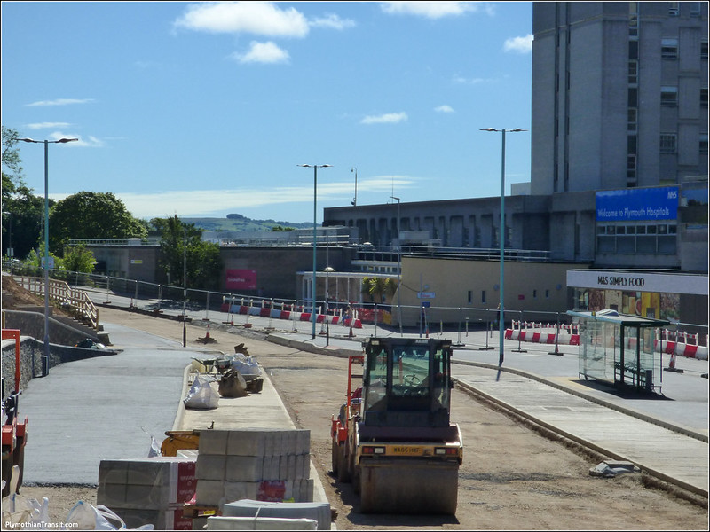
P1020724.jpg P1020727.jpg The three original shelters have been installed at the bus stops. P1020731.jpg P1020733.jpg P1020734.jpg The new bus stops on the left hand side can be seen here which will take buses heading back up towards The George (via the new Airport Link Road) and also the 50 etc out towards Estover. Plymouth Citybus 084 WJ55HLN The temporary arrangements that have been in place for the last few months were less than ideal. The lack of space and awkward layout meant buses were often queued up behind each other. It was difficult to get the buses close to the kerb for easy wheelchair access and there were no shelters for passengers.  The pavement at the front of the hospital was very narrow which meant that the electric golf cart in use for the less mobile which can be seen just behind Citaro 84 had to fight its way through crowds of people waiting for the buses. All of this has now changed for the better…

20160728_165537 Taken this week, we see the new road in use with its nice new bus stop layout. Its still a temporary layout as buses are still only one way so just the stops here on the right are in use. At the moment this is still quite a bit less space than the old road layout so buses are still bunched up and double parked but there is generally plenty of room for this to happen at the moment. The old road to the right of the new stops is now being ripped up and a new layout put in place. Once this is ready then the full scheme with buses in both directions will take effect. The lack of any shelters on the left will be noted and is hopefully going to be sorted shortly.

30 November 2015

Derriford: The next stage

The next stage of major transport works around Derriford Hospital are a step nearer:

Plans to improve Plymouth’s second busiest bus interchange have been submitted by the Council. The Derriford Hospital Interchange scheme, estimated to cost just over £2 million, will convert the existing one-way bus link through the hospital to allow buses to travel in both directions. It will also create separate taxi and passenger drop-off points and provide three additional bus stops. As well as reducing congestion outside the main entrance and making bus journeys to and from the hospital quicker and more reliable, the scheme will provide better waiting areas for bus and taxi passengers and those getting dropped off or picked up by car.

The Heart-of-the-South-West Local Enterprise Partnership – the body responsible for allocating funding for large-scale transport schemes across Plymouth, Devon, Torbay and Somerset – has recognised the regional importance of the scheme with a £1.4 million award from its Growth Fund. The remaining funding will be provided by the Council and the Plymouth Hospitals NHS Trust. People can view the planning application on our website and staff will be at Derriford Hospital (main entrance) on Monday 7 December (9am to 1pm) and Friday 11 December (2pm to 6pm) to discuss the plans and answer any questions.The closing date for comments is Tuesday 22 December. If the planning application is approved, construction is planned to start in the New Year and will take around nine months.

The Derriford Hospital Interchange scheme is part of a ‘master plan’ of highway improvements that will help unlock development and deliver 9,000 new jobs and 3,000 new homes in the north of the city. Other schemes include the proposed Forder Valley Link Road, which was recently earmarked to receive £22.5 million from the Growth Fund, as well as the new Marjon Link Road, which opened in September.


Planning Web Site for full details of the planning application

Derriford Hospital: After

Bus Stop


As usual this will cause traffic chaos while the work is in progress, but it should make a big difference for passengers once its all in place. With buses going through the site in both directions it should cut down on passengers running for buses going the wrong way. Every day you see passengers running up from one bus stop when they see a 42 (for example) stop at the other end. At least now buses will be heading off in different directions. It will also give them a lot more room for buses to actually stop which is a major cause of problems at Derriford every day

05 October 2015

Derriford–The next stage

Detailed plans for improving traffic flow in the Derriford area will be on public display next week.

The Derriford Transport Scheme, which will see improvements on the A386 Tavistock Road, aims to reduce congestion and create more road capacity for the extra traffic that will be generated by proposed developments in the area. It will also include better facilities for public transport, walking and cycling.

A preferred option was chosen in December 2014 following consultation with residents and businesses and we are now inviting people to view and comment on more detailed designs before the scheme is finalised.

Derriford Roundabout and the William Prance Road junction will be upgraded with additional traffic lanes, new bus lanes and improved traffic signal operation, as well as new, marked cycle lanes and new pedestrian crossings. Walking and cycling improvements will also extend towards The George Park and Ride.

People will be able to view and discuss the latest plans at two public exhibitions being held at our Windsor House building on Tavistock Road:

  • Thursday 8 October (3pm to 7pm)
  • Saturday 10 October (10am to 2pm)

The next step will be to develop a final business case for approval by the Heart-of-the-South-West Local Enterprise Partnership (HotSW LEP), which is contributing £10.16 million towards the £12.72 million scheme. Construction is expected to get under way in Spring 2016 and take around 12 months.

The Derriford Transport Scheme is part of a ‘master plan’ of highway improvements that will help unlock development and deliver 9,000 new jobs and 3,000 new homes in the north of the city.

The first of these essential infrastructure improvements is the newly opened Marjon Link Road and funding has already been earmarked for future phases including the proposed Forder Valley Link Road.

Councillor Mark Coker, Cabinet Member for Strategic Transport and Planning, said: “The A386 is the main route to and from the north of the city – including Derriford Hospital, the University of St Mark and St John and the Plymouth Science Park. It is often congested, especially at peak times and future growth in the area will put even more pressure on this busy part of our transport network. The Derriford Transport Scheme, together with our other planned infrastructure improvements, will help to keep traffic moving, improve bus journey times and reliability and provide better walking and cycling facilities along this key route.”

What is the Derriford Transport Scheme?

The Derriford Transport Scheme aims to reduce congestion between Derriford Roundabout and William Prance Road and create more road capacity for the extra traffic that will be generated by proposed developments in the area. Bus priority measures will be provided at both junctions to improve journey times and make services more reliable, particularly to Derriford Hospital. Pedestrian crossing facilities and on-road cycle facilities will also be improved.

This section of the A386 is a key route for people travelling between the city centre and the north of the city and it provides access to key destinations such as Derriford Hospital, the University of St Mark and St John and the Plymouth Science Park. Both Derriford Roundabout and William Prance Road manage very large volumes of traffic throughout the day and are often congested at peak times.

Proposed developments in the Derriford and Seaton areas could see around 3,000 new homes, as well as a new district centre, new shops and businesses and a new school. This will increase the number of people travelling to and from the Derriford area and put further pressure on the transport network.

How will the scheme be paid for?

The Department for Transport allocates funding for large scale transport schemes to Local Enterprise Partnerships (LEPs). The Heart-of-the-South-West (HotSW) LEP covers Plymouth, Devon, Torbay and Somerset and it is currently considering which schemes from across its region should receive funding.

One of the schemes shortlisted for the first round of available funding is the Derriford Transport Scheme. In addition to the LEP funding we also have to provide a local financial contribution and it is anticipated this will come from new developments in the Derriford and Seaton areas.

When will work begin?

Subject to the HotSW LEP providing final approval for funding, it is expected that construction would start in 2016 and is likely to take about 12 months.

Options considered

We have carried out a considerable amount of feasibility work to see how we can improve the flow of traffic along this busy route and manage the additional journeys that will come from future developments. We have also looked at how we can provide greater priority for buses and better facilities for pedestrians and cyclists, so we can encourage more people out of their cars and help to keep our transport network moving as the city grows.


Preferred option

In deciding which scheme to take forward, we have considered the consultation results, along with other factors such as impact on the wider road network and the environment, cost and value for money.

The preferred option is to upgrade the existing roundabout to provide additional traffic lanes, new bus lanes and upgraded traffic signals along with walking and cycling improvements. Keeping the roundabout means all current traffic movements can be maintained (including the ability to 'U-turn' using the roundabout), the impact on trees and vegetation will be reduced compared to the other options considered and traffic flow will be significantly improved.

This will be combined with improvements to the William Prance Road junction, including new lanes for general traffic as well as buses.

 Derriford

20 July 2015

Marjon Link Road Works

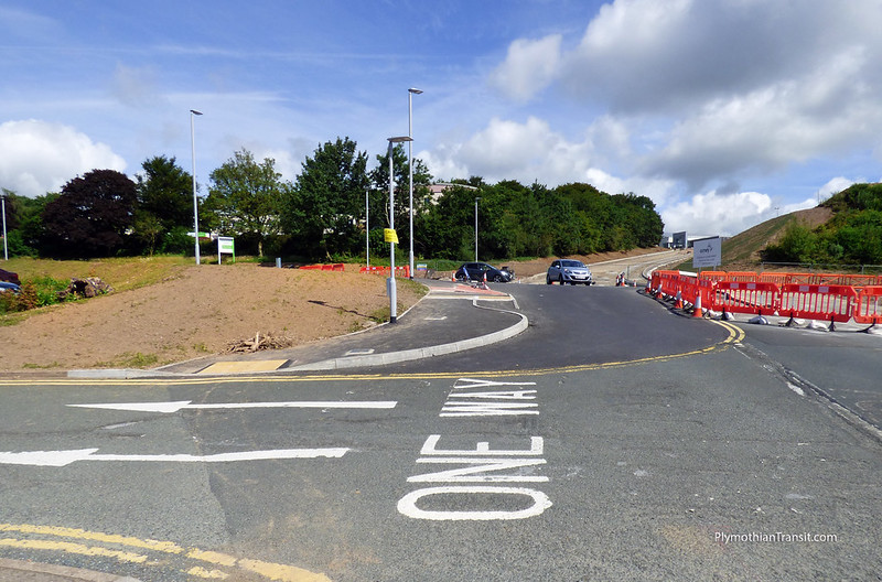
Finally managed to get to Derriford and take a few photos of the new Marjon Link Road works which are coming along nicely.

P1010165.jpg

Looking back up from Derriford Hospital the darker tarmac here is the new part of the road. This will be the exit lane eventually.

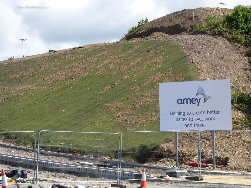
P1010169.jpg

A closer view of the impressive banking which now has this grass blanker to keep everything in place. This has been a major excavation.

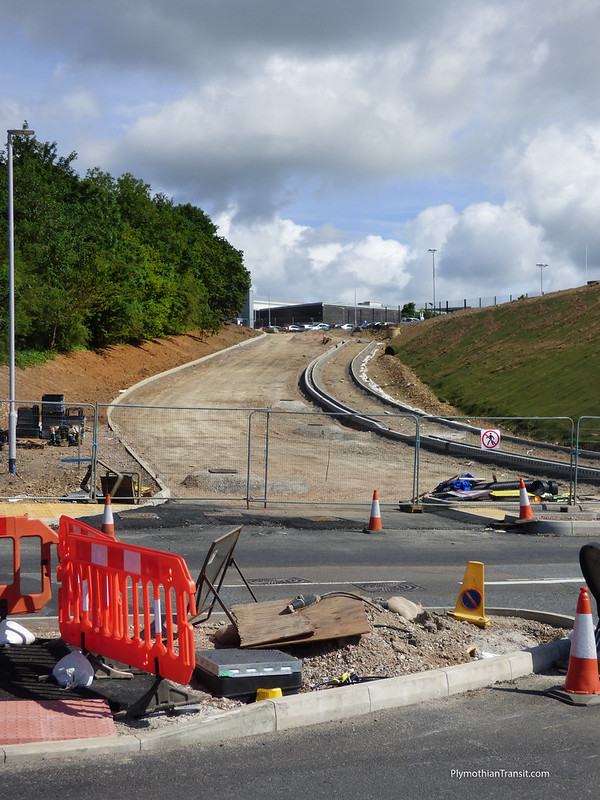
 P1010170.jpg

A closer look at the new Marjon Link Road which is rapidly taking shape. This will be a new two way bus lane which leads up to join the new bus only route through the old Plymouth Airport.

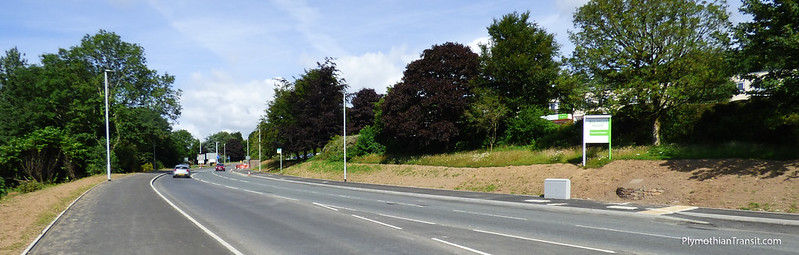
P1010171.jpg

Looking back along the main road which is now quite a bit wider. The paths just need the final surface and then the road resurfaced.

P1010173.jpg

The new crossroads junction at the entrance of Derriford Hospital. This will be traffic light controlled once its all operational.

P1010191.jpg

The main p[art of the junction still to be completed is the inbound lane. The new traffic island on the left is pretty much where the old exit lane used to be. The wall on the right is part of the new Heliport which has just recently been completed.