Showing posts with label Traffic management. Show all posts

04 July 2018

Mannamead Mayhem?

Another major traffic improvement scheme is about to start in Plymouth. Although in the long run this should improve traffic flow and help the buses, it will mean more delays while the work is underway…

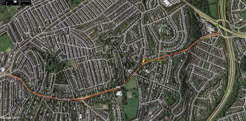
The Mannamead Road Junction Improvement Scheme is set to get underway.

Modern and efficient signals will be installed at a number of junctions along the route with the aim of reducing traffic delays between Torr Lane and Mutley Plain, reducing journey times for motorists and improving service reliability for buses.

As well as replacing worn out and outdated traffic signals, the scheme will also address road safety with upgrades to pedestrian crossings and by providing better facilities for cyclists.

Work is due to begin on Wednesday 18 July and is expected to last for around five months. Mannamead
Councillor Mark Coker, Cabinet Member for Strategic Planning and Infrastructure said: “This is a key road for people who are travelling into both the city centre and the district centre at Mutley Plain from the north and the A38. It is crucial to keep traffic flowing and support greener travel as Plymouth continues to grow.

“These improvements will reduce queueing, particularly during the morning and evening rush hours and make it safer and easier for people to walk and cycle along this busy road.”

As part of the scheme, the layout of the junction of Torr Lane and Mannamead Road will be improved and new Toucan pedestrian and cycle crossings provided. A new off-road shared pedestrian and cycle lane between Torr Lane and the Manadon junction will also be provided.

Meanwhile, 13 on-street parking spaces, which are currently restricting traffic flow on the approach to Mutley Plain, will be removed.

Eight replacement spaces will be provided, split between College Avenue and Connaught Avenue, while Mutley Barracks car park will be free for the first hour during the day and also from 8pm every night.

The main construction work will take place between 7.30am and 6pm, Monday to Friday, and on the occasional Saturday morning between 7.30am and 1pm.

Work will start at the Torr Lane junction before moving onto the junctions further south. However it should be noted that works will be taking place along the length of Mannamead Road (and in particular between Torr Lane and Seymour Road) throughout the construction period.

Whilst every effort will be made to keep disruption to a minimum whilst work is taking place, temporary three-way lights will be required at various locations throughout the construction period to allow the existing signals to be replaced. Every effort will be made to have only one set of temporary lights in operation at a time and they will be manually operated during busy times of day to minimise disruption.

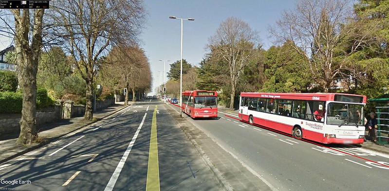
The southbound bus lane from Russell Avenue to Torr Lane will be closed from late September for around one month. The northbound bus lane from Whiteford Road to Hartley Road will be closed from late August for around three months. It is expected that all bus stops on Mannamead Road will remain open throughout the works. manna1
It will also be necessary to close the entrance and exit of Torr Lane, at its junction with Mannamead Road, between 9.30am and 3.30pm, for three days at the end of September. Suitable diversions will be in place during this closure.

Regular users of this route are advised to plan ahead and allow extra time for their journey.

The scheme is estimated to cost around £1.7 million, with over £1 million being provided by the Heart of the South West Local Enterprise Partnership.

It is part of a masterplan of highway improvements that will help unlock development and help deliver new jobs and homes in the north of the city, complementing other transport schemes along the Northern Corridor including the recently completed Outland Road Junction Improvement Scheme and Derriford Transport Scheme.

For more information on the scheme including traffic management, visit the Mannamead Road Junction Improvement Scheme page. In the event that the programme changes due to unforeseen circumstance, updates will be published there and on the Council’s Facebook and Twitter pages.

You can also sign up to receive the Council’s weekly roadworks roundup. Notices will also be placed on site in advance detailing any closure, restriction or diversion and will also be advertised in the local press.

The post Main work set to start on Mannamead Road junction improvements appeared first on Plymouth News Room.


23 February 2017

Woolwell and Outland Road

Catching up with some Plymouth City Council news…

Bottleneck

Plans to tackle one of Plymouth’s worst traffic bottlenecks have been given the green light.

We have allocated £420,000 for design work on a scheme to alleviate congestion at the notorious pinch point between Woolwell Roundabout and The George. We have also committed more than £15 million in its capital budget to deliver the scheme, which will help reduce congestion along the A386 Tavistock Road and support proposed new developments in the north of the city. We are exploring options to widen the road between Woolwell Roundabout and The George and provide two lanes in each direction, removing the need to merge and reducing journey times for everyone. The scheme will also include plans to upgrade the junction with Woolwell Road, as well as improved public transport, walking and cycling links.

The Plymouth and South West Devon Joint Local Plan, due to be published later this month, identifies Derriford and the northern corridor as one of three strategic growth areas where most of the planned growth in the city will take place through to 2034. The vision for this area is that it will be transformed to create a high quality, distinctive, vibrant, mixed-use new heart for Plymouth. The vision supports major investments and radical improvements in transport infrastructure and the Woolwell to the George project is the flagship infrastructure project as part of this.

Plymouth City Council George Woolwell

Plan

An ambitious plan for what Plymouth and South West Devon could be like in 2034 covering important issues like health, transport, homes, jobs and the economy, green spaces and infrastructure is to be considered by three councils next week.

The Plymouth and South West Devon Joint Local Plan is going to the Full Council in each local authority on the following days:

• Plymouth – Monday 27 February
• West Devon – Tuesday 28 February
• South Hams – Thursday 2 March

The Joint Local Plan is a culmination of months of planning and discussions between local communities, neighbouring councils, landowners, businesses and developers, interested in shaping the future of the area.

Councillor Patrick Nicholson, Deputy Leader and Cabinet Member for Strategic Housing, Transport, and Planning said: “This plan is vital for the future success of Plymouth, West Devon and South Hams. We have planned for the new homes and jobs that we need so that the area can thrive. A huge amount of work has gone on behind the scenes to take on board as many different views as possible. Here in Plymouth we’ve made huge efforts to strike the right balance between the need for growth and protecting our important green spaces for generations to come.

All three councils will be asked to agree that the Joint Local Plan is ready to submit to an independent Government Planning Inspector and if approved, a final consultation will get underway and will run from 15 March to 26 April 2017. This will be the last chance for the public to comment on the Joint Local Plan before it is formally submitted for examination. At this stage, the public and other interested organisations will be able to make comments but these need to relate to the soundness of the plan.

For more information visit http://web.plymouth.gov.uk/plymouthplan

Outland Road

Work to improve a key junction on one of the busiest roads into the city is nearing completion.

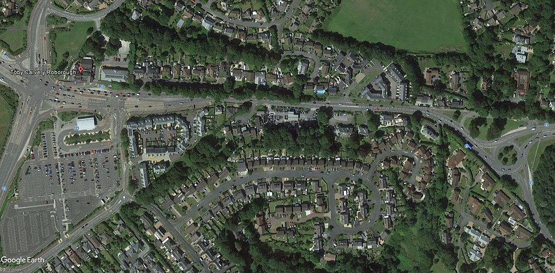
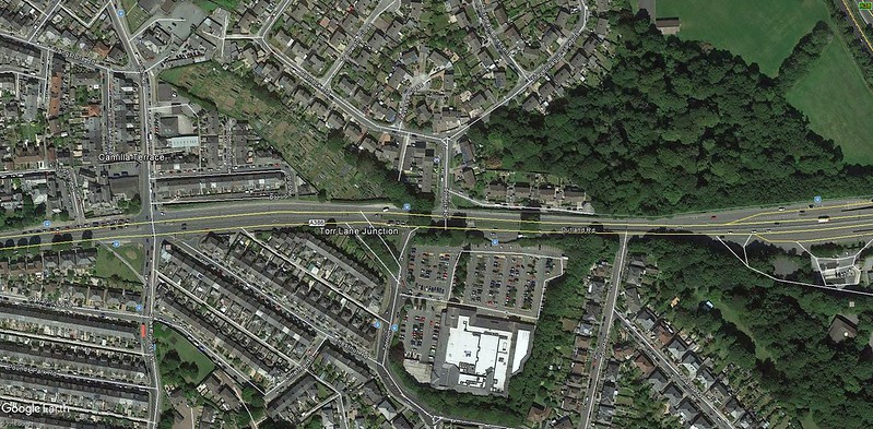
The Outland Road Junction Improvement Scheme aims to reduce congestion between Peverell Park Road and Torr Lane, improving journey times for motorists and service reliability for buses on this busy route. It will also improve road safety by upgrading pedestrian crossings and providing new on-road cycle lanes.

The first phase of the scheme at Peverell Park Road was completed in March 2016. The main works between Torr Lane and Weston Park Road / Ham Drive junctions began construction in September 2016. The original programme had a completion date of March 2017 but the contractor uncovered poor ground conditions that resulted in the completion date extending by a few weeks. This was unfortunately unavoidable.

We are coming towards the end of the scheme and aim to have the improved junction at Torr Lane reopened next week, which will alleviate much of the disruption to local residents and businesses. The current closure of Weston Park Road is also due to be lifted at the end of this week. From next week there will be a westbound closure of Ham Drive between Outland Road and Camilla Terrace, which will be in place for a maximum of three to four weeks. As with all the road closures so far, signed diversions will be in place for both motorists and pedestrians.

The diversions are essential in order for the works to be carried out safely, with the minimum amount of disruption to all road users. With a scheme of this size, at such a sensitive location, it is not possible to provide improvements without some delays being experienced. However we are trying to keep these to a minimum as far as possible.

Although there has been some weekend and night working to reduce the length of the construction period, this is disruptive to those living close by and the associated costs are substantial.

We work closely with the contractor, Amey LG, to ensure the scheme is delivered as far as is possible within the programme timescales and budget. Although there has inevitably been some disruption, the scheme will have significant benefits for the city in terms of providing better transport facilities for the future outland

05 September 2016

Bodmin Buses Budged out of the way

Thanks to the person who left a comment earlier, as this has quite an effect on local bus services in and around Bodmin, including the Plymouth service:

From Monday 12 September, there will be a number of changes to local bus services in Bodmin as a result of the closure of several roads in the town centre.

Plymouth Citybus Service 11A  Plymouth – Liskeard – Bodmin – Wadebridge – Padstow

This service will not be able to follow its normal route in and out of Bodmin from the Liskeard direction. During the works it will operate from Carminnow Cross, via Carminnow Road, Normandy Way, Harleigh Road, St Nicholas Street to Mount Folly. It will then turn in the Priory Car Park before continuing its route towards Padstow, via St Nicholas Street, Plas Newydd Avenue (outbound), Harleigh Road (inbound), Beacon Road, Barn Lane, Westheath Avenue and Boundary Road. Services from Padstow towards Liskeard will follow the reverse. For the duration of the works, due to the closure of Turf Street, the service will not be able to serve Morrisons.

First Kernow Service 27   Truro – St Austell – Bodmin

All journeys in and out of Bodmin will operate via Westheath Avenue, Barn Lane, Beacon Road, Harleigh Road (inbound),  Plas Newydd Avenue (outbound), St Nicholas Street to Mount Folly. For the duration of the works, due to the closure of Turf Street, the service will not be able to serve Morrisons and will instead turn in Priory Road Car Park.

First Kernow 55  Camelford – Bodmin

All journeys in and out of Bodmin will operate via Dunmere Road, Barn Lane, Beacon Road, Harleigh Road (inbound), Plas Newydd Avenue (outbound), St Nicholas Street to Mount Folly. For the duration of the works, due to the closure of Turf Street, the service will not be able to serve Morrisons, and will instead turn in Priory Road Car Park.

Age UK 405 Pedna Carne – St Columb Major – Rosenannon – Nanstallon – Bodmin

All journeys in and out of Bodmin will operate via Dunmere Road, Barn Lane, Beacon Road, Harleigh Road (inbound), Plas Newydd Avenue (outbound), St Nicholas Street to Mount Folly. Sainsburys and Morrisons will be served on request to the driver.

Travel Cornwall 454  Bodmin Town Service

A revised timetable providing an hourly service will be in operation for the duration of the works, serving all main stops.

Travel Cornwall 455 Bodmin – Bodmin Parkway

This service will not be able to follow its normal route in and out of Bodmin from the Liskeard direction. During the works it will operate from Carminnow Cross, via Carminnow Road, Normandy Way, Harleigh Road (inbound), Plas Newydd (outbound) St Nicholas Street to Mount Folly. It will then turn in the Priory Car Park running the reverse route.  For the duration of the works, due to the closure of Turf Street, the service will not be able to serve Morrisons.

Travel Cornwall 482 Polruan – Polperro – Bodmin

Into Bodmin the journey will operate from Carminnow Cross, via Carminnow Road, Lostwithiel Road, Harleigh Road (inbound), Plas Newydd (outbound), St Nicholas Street to Mount Folly. It will then turn in the Priory Car Park before serving the Morrisons and Asda supermarkets.

National Express coaches

For the duration of these works National Express will suspend services to Wadebridge. Arrivals and departures will be from Priory Road opposite Morrisons for all journeys.

Source: Cornwall County Council

The Bodmin Cycle Project?

Works are underway to create a cycle link between Lanhydrock, the Camel Trail and Cardinham Woods, connecting Bodmin to these popular cycle hubs. By bringing the popular Camel Trail into the heart of Bodmin, we hope it will act as a catalyst for the regeneration of the town centre.

The works are made up of 12 separate schemes, ranging from minor highway changes to new junctions. The most significant section of works will be at the area of Dennison Road, Church Square and Turf Street which will result in widened pavements, narrowed carriageways and new surfacing, including an attractive granite paved area at Church Square. A new roundabout will also be built at the Priory Road and Launceston Road junction to improve traffic flows and safety, including the movement and crossing of pedestrians and cyclists. There will be a new shared use routes through Priory Park linking to St Petroc’s School providing safe access for children walking and cycling to school.

Source: Cornwall County Council

Scheme History

Walking and cycling have been identified as the solution to Bodmin’s growth challenges. Studies undertaken by Department for Transport have shown that for every £1 spent on cycling, the local economy can expect to see a return in the region of £4.

The delivery of a fully comprehensive joined up walking and cycling network, capitalising on the existing surrounding attractions, is key to uniting Bodmin and supports the high growth agenda, will manage current air quality issues, supports education expansion, stimulates economic growth and can provide a national model for creating the conditions for modal shift in a rural environment. 

Bodmin town is situated at one end of one of the most highly used cycle routes in the country (the Camel Trail) and is also within close cycle distance of two recently upgraded cycle ‘hubs’ at Cardinham Woods and Lanhydrock House (National Trust). Despite its location, Bodmin reaps little economic benefit due to the lack of connectivity between these significant cycle attractions and a poor quality, fragmented, town centre network.  

The infrastructure network required to support this growth and manage the existing Air Quality Management Area in the town centre has been the source of recent significant contention amongst the town, particularly regarding new road infrastructure. The single, unifying proposal across the town’s residents and businesses has been to develop a fully integrated cycle network that will support growth, improve economic productivity, manage air quality and put Bodmin firmly on the map as being a cycling destination.

16 March 2016

Derriford Transport Scheme Next Stage

More on the latest developments around Derriford

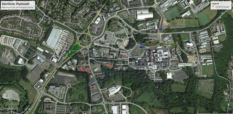
Major transport improvement plans for the north of the city have taken a major step forward, with the appointment of the main contractor for the Derriford Transport Scheme. The contract has been awarded to Amey LG Ltd following a competitive tender process and construction work is expected to begin in July.

The Derriford Transport Scheme will help to reduce congestion along Tavistock Road and create more road capacity for the extra traffic that will be generated by proposed developments in the area. It will also include better facilities for public transport, walking and cycling. Derriford Roundabout and the William Prance Road junction will be upgraded with additional traffic lanes, new bus lanes and improved traffic signals, as well as new, marked cycle lanes and new pedestrian crossings. Walking and cycling improvements will also extend towards The George Park and Ride. A preferred option has been chosen and scheme designs are being finalised following public consultation in 2014 and 2015.

Derriford is an area that is undergoing vast change, significant to the city’s future. A vision to establish a new heart for the north of the city was first proposed in Plymouth’s Core Strategy in 2007 and Derriford has since been identified as a key area to deliver growth in housing, employment and associated infrastructure as part of the Plymouth Plan. Central to this vision is a transport network that can connect people to new homes, jobs and leisure and health facilities. The Derriford Transport Scheme is part of a master plan of highway improvements that will help to achieve this and deliver jobs and homes in the north of the city.

It will be supported by other essential infrastructure improvements in the area including the new Marjon Link Road (which opened in the autumn), the Derriford Hospital Interchange and the proposed Forder Valley Link Road. The Heart-of-the-South-West Local Enterprise Partnership (HotSW LEP) is contributing £10.16 million towards the £12.72 million scheme.

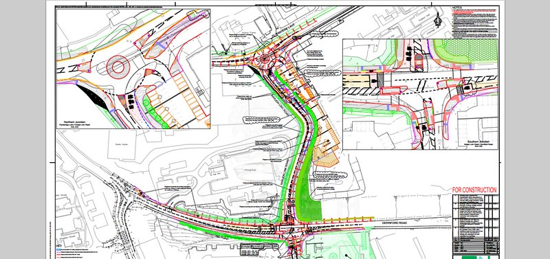
For more information visit www.plymouth.gov.uk/derrifordtransportscheme. Derriford Scheme

19 December 2014

Derriford Marjon Link

The fun starts very soon

Staff at Derriford Hospital have received this email giving advance warning of the major scheme starting next year...

As many of you are now aware preliminary works on enhancing the Marjon Link Road started on the 8th December. The purpose of this email is to give staff advance warning of the full commencement of the works from the 5th January 2015 until their estimated completion on the 4th September 2015.

The outline of the scheme, its purpose and schematic drawings can be found on the Plymouth City Council website. If you want to find out more please click on this link: www.plymouth.gov.uk/marjonlinkroad

These works will be undertaken in three simultaneous phases:

  • Improve the roundabout at the top of Marjon Link Road
  • Widen and upgrade Marjon Link Road
  • Widen Derriford Road, install a right hand only turn into the Hospital at the bottom of the Marjon Link Road and install three way traffic lights and pedestrian crossing points at the bottom of Marjon Link Road
The third aspect of this scheme will have the greatest impact on Derriford Road and access/egress from the Hospital. To undertake this safely and allow for the two way flow of traffic along Derriford Road to continue during the works the following traffic management measures will be put in place.

Marjon Link Road will be closed to vehicles, cyclists and pedestrians from 05/01/15 – 04/09/15

Traffic entering the Hospital will still be able to travel along Derriford Road and turn right to access the Hospital opposite Marjon Link Road Traffic leaving the Hospital will not be able to exit onto Derriford Road opposite Marjon Link Road but will have to do so by travelling in front of the main entrance and using the mini-roundabout onto Derriford Road

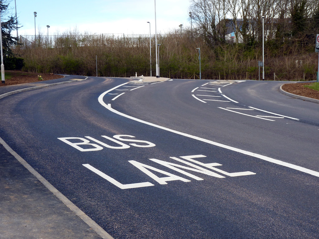
The current Bus Only lane which leaves the Hospital and travels to Derriford Roundabout will be suspended to allow any vehicle to use the Bus Lane to exit the site. We fully appreciate these works will cause disruption to travellers but the plans outlined above will cause less disruption than 3 way temporary traffic lights on Derriford Road would cause for the same duration. Naturally all traffic management measures will be constantly reviewed and varied if required.

Bus Lane

The loss of the full bus lane out of Derriford Hospital and onto Derriford Roundabout is bound to cause some delays to buses serving the area but hopefully the temporary one way system within the Derriford site will help. It should help the 50 I catch as we don't get the luxury of a bus lane out of Derriford and then get caught up with the traffic queuing to get into Derriford.

The scheme detail

www.plymouth.gov.uk marjon_link_road_scheme_drawing.pdf

Larger view (PDF)

Recommended Reading

18 April 2007

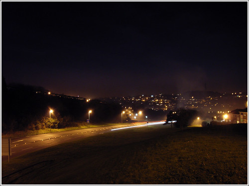
Novorossisk Road at Night


Novorossisk Road links the main industrial estates of Estover with Forder Valley Road and also provides a short cut for traffc coming from The George to Marsh Mills so it gets very busy here these days.

This is one area where traffic management improvements have actually worked really well. There is a new junction at the bottom of the hill with Forder Valley Road which keeps traffic moving fairly well, although Forder Valley Road itself is still a bottleneck.