
I mentioned a while ago that there was a new service from the City Council called Plymgo which would be launched soon. Well there is now a ‘Beta’ version of the service up and running:PLYMGO BETA LINK
Please note: This is a beta site under development. New features are being added all the time and some existing features may not work as expected.
To be kept up to date with improvements, please register on www.plymgo.com 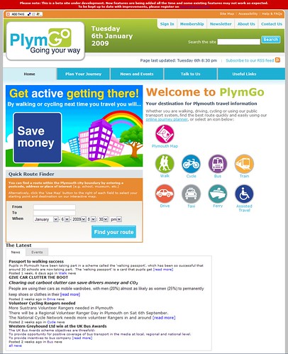
First impression are good! It looks well designed and friendly enough for people to give it a go.
Many of the links at the top of the page are not working yet (it is still in Beta after all)
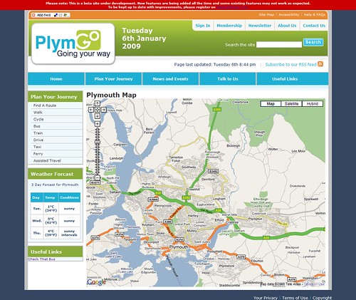
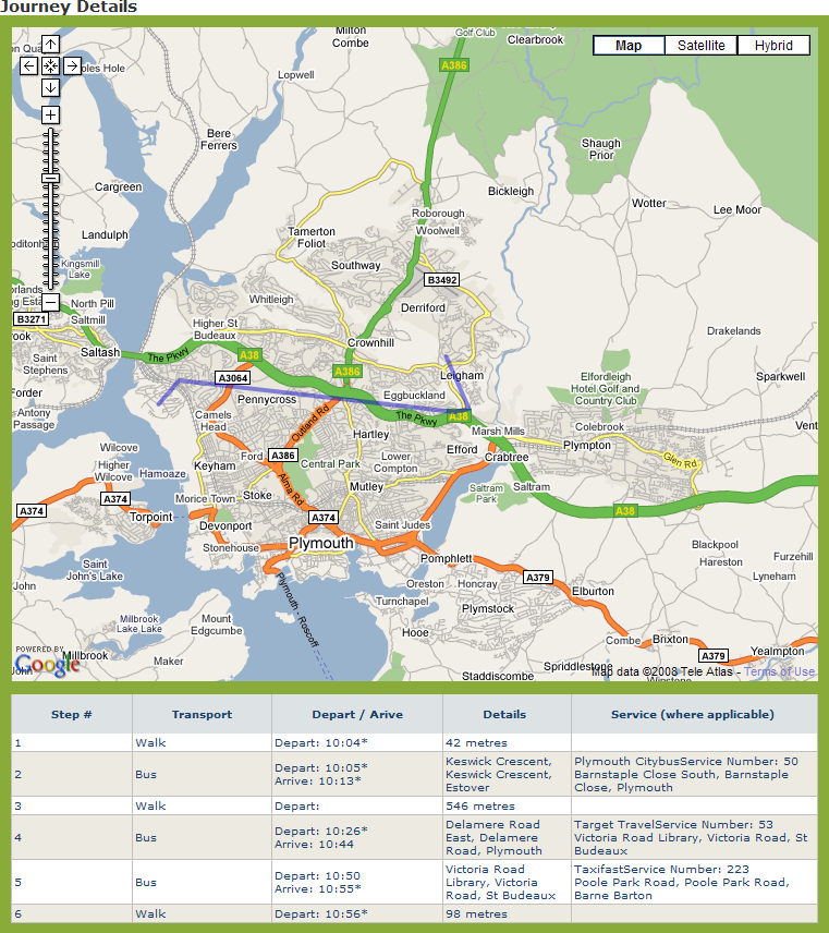
Clicking on the Plymouth Map icon brings up a map of Plymouth - which is what you would expect. The really good news is that this is a Google Map and comes with all the features and usability that you expect from Google. A big improvement over the Check that bus site.
You then get several icons depending on your mode of travel. For each of these you get a very similar page which offers the latest related news items (not much there yet but it will grow!)
and events.
It a few cases it also points you to related web sites, such as the Trains page points you to First Great Western for timetables etc.
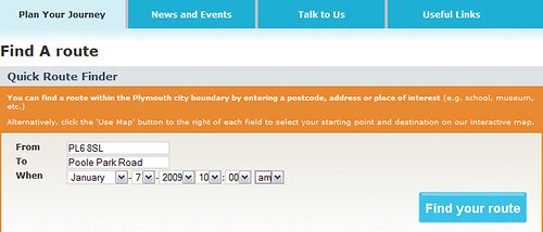 So lets try the route planner and see if I can get to Poole Park Road from Keswick Crescent…
 simply select the location using name or postcode and the date and time you want to travel then click find your route.
You will get to confirm that the route finder is using the correct locations and then you get a screen of options. I assume that the cost, emissions and calories used sections will get added in due course.
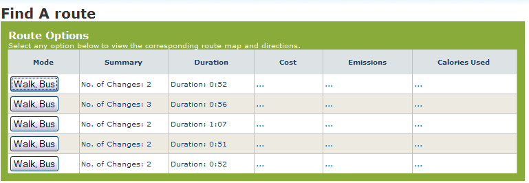
So lets look at option 1:
I must admit this is not one that I would have looked for, but then I don't like walking! 546 metres isn't that much of a walk so it looks promising if its not raining. Lets look at number 2:
Actually - lets not! Although the main screen offers me 5 options with either 2 or 3 changes and journey times varying from 51 minutes to 1 hour 7 minutes at the moment the journey details all read exactly the same. This seems to happen on all the routes I have checked but I am sure it will be fixed before it comes out of Beta!
Conclusion?
I have to admit that I am impressed so far. The site as it stands makes it clear that it is not the final product so the issues I raise above are only to be expected. It is however working well enough to demonstrate that it has great potential and its something that I will be keeping an eye on over the coming months. Well done to all involved.
I for one cant wait to see how it develops.
Now if they could just incorporate the awful check that bus site into this one using these maps…
Hi. Thanks for your positive comments about the initial relase of plymgo, which we made public on Xmas eve 2008. The version that you can see at the moment is pretty thin on features, but we have another release planned for Jan 9th and further updates are in the pipeline. We do indeed intend to incorporate Check That Bus, probably by allowing a plmygo user to view a clickable map of available bus stops that will link through to the right information on the CTB site. We are really excited by the project's potential and we are looking forward to extending the range of content and tools over the coming months. Regards - Jonathan Grove: www.futurate.com
ReplyDeleteAs part of our ongoing improvements we have now added the ability for plymgo.com users to combine journey plans with information about amenities and attractions in the city (all displayed on a Google map). There currently isn’t a huge amount available (just information about theatres and museums) but this will grow over the coming months and we are considering allowing members of the public the ability to add items to the map themselves. To see this new function in action, find your route, view directions, click the ‘options’ tab and select the geographic features to display on your map. For further information about an amenity or attraction, click the icon on the map. A new release of Plymgo which will feature additional functionality such as route planning for drivers is due for release week beginning January 19th 2009.
ReplyDeletewww.plmygo.com
ReplyDeletewww.plymgo.com actually!
ReplyDelete